Amalfi Coast Map — Explore Towns, Beaches, Ferries & Parking
This Amalfi Coast map plots the towns, beaches, ferry ports, parking and main sights along Italy's Sorrentine Peninsula, south of Naples — from Positano in the west to Vietri sul Mare in the east, with Ravello on the hills above Amalfi. Switch area to explore Capri and Ischia, or enable SITA stops for coastal bus connections. Explore it below: filter by what you like, tap a place for details, and build your own day.
Amalfi Coast map — towns & villages
The whole coast at a glance: Positano, Amalfi and Ravello, the villages between them, inland Scala and Tramonti, plus Sorrento and the island of Capri. Free to download and print. Explore the interactive map below for beaches, ferries and parking.
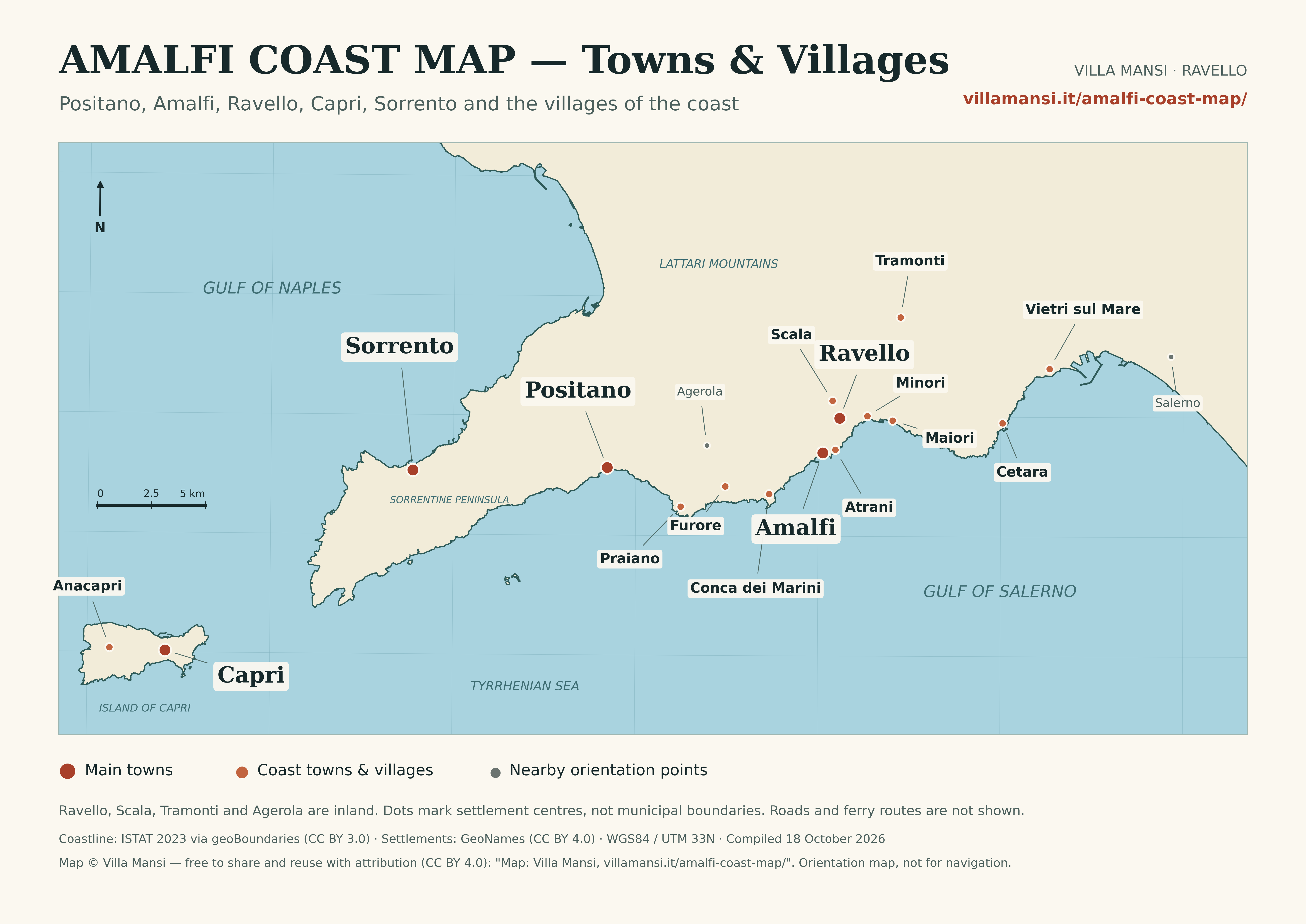
Free downloads: High-resolution PNG (6000 × 4244) · Printable PDF (A4, vector) · WebP (2400 px) · SVG
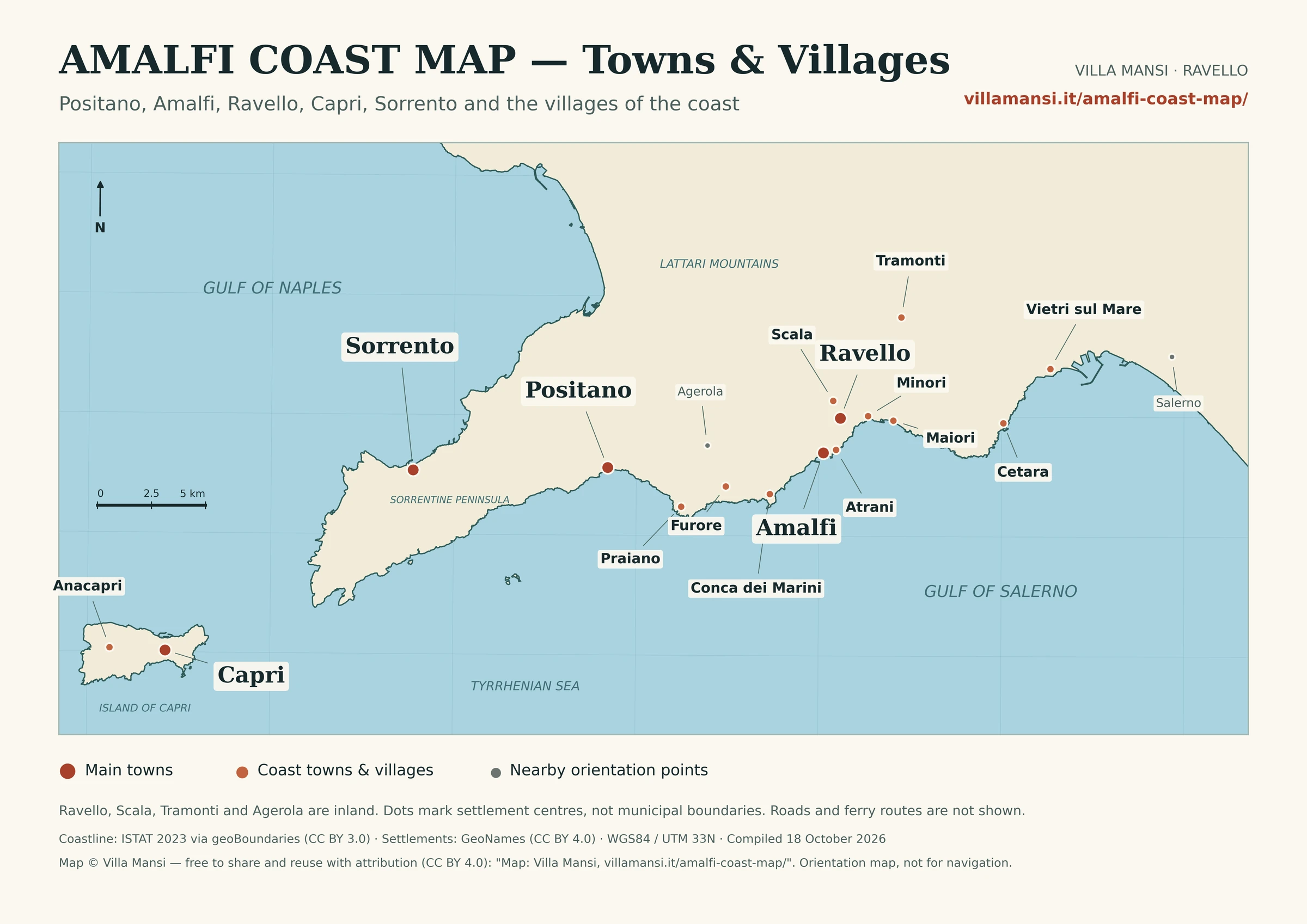
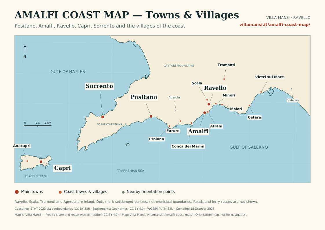
Licence: map © Villa Mansi, free to share, print and reuse — including on your website or in print — with attribution (CC BY 4.0): “Map: Villa Mansi, villamansi.it/amalfi-coast-map/”. The underlying coastline and settlement data keep their own CC BY licences, credited above.
Images marked “AI illustration” are place-inspired reconstructions, not documentary photographs or evidence of current conditions. Landmark photographs retain their original credits below.
Landmark photo credits
Photographic sources and licences. AI-enhanced photographs are identified in their captions. Images do not establish current conditions or opening hours.
- Villa Rufolo: Costiera amalfitana ravello-villa rufolo-giardino4-commons.jpg — Rinina25 & Twice25 · CC BY 2.5. AI-enhanced lighting, colour and detail, based on the credited original; resized to WebP. Not evidence of current conditions.
- Villa Cimbrone: Cimbrone terraza infinito 01.jpg — Miguel Hermoso Cuesta · CC BY-SA 4.0. AI-enhanced lighting, colour and detail, based on the credited original; resized to WebP. Not evidence of current conditions.
- Amalfi Cathedral (Duomo di Sant'Andrea): Amalfi fachada catedral.jpg — Miguel Hermoso Cuesta · CC BY-SA 4.0. AI-enhanced lighting, colour and detail, based on the credited original; resized to WebP. Not evidence of current conditions.
- Castiglione di Ravello (Ravello Mare): — Geofix · CC BY-SA 3.0. AI-enhanced lighting, colour and detail, based on the credited original; resized to WebP. Not evidence of current conditions.
- Santa Croce beach: — No machine-readable author provided. Sudodana2048 assumed (based on copyright claims). · CC BY-SA 3.0. AI-enhanced lighting, colour and detail, based on the credited original; resized to WebP. Not evidence of current conditions.
- Marina Grande beach — Capri: — Ekrem Canli · CC BY-SA 4.0. AI-enhanced lighting, colour and detail, based on the credited original; resized to WebP. Not evidence of current conditions.
- Marina Piccola — Capri: — Bicloch · CC BY 3.0. AI-enhanced lighting, colour and detail, based on the credited original; resized to WebP. Not evidence of current conditions.
- Punta Carena swimming rocks: — Dr Tr from Saint-Petersburg, Russia · CC BY 2.0. AI-enhanced lighting, colour and detail, based on the credited original; resized to WebP. Not evidence of current conditions.
- Maronti beach: — Grauesel · CC BY-SA 3.0. AI-enhanced lighting, colour and detail, based on the credited original; resized to WebP. Not evidence of current conditions.
- Citara beach: — Abxbay · CC BY-SA 4.0. AI-enhanced lighting, colour and detail, based on the credited original; resized to WebP. Not evidence of current conditions.
- San Montano bay: — Vito Calise · Public domain. AI-enhanced lighting, colour and detail, based on the credited original; resized to WebP. Not evidence of current conditions.
- Grotta Azzurra — Blue Grotto: — Glen Scarborough · CC BY-SA 2.0. AI-enhanced lighting, colour and detail, based on the credited original; resized to WebP. Not evidence of current conditions.
- Monte Solaro: — Falk2 · CC BY-SA 4.0. AI-enhanced lighting, colour and detail, based on the credited original; resized to WebP. Not evidence of current conditions.
- Giardini di Augusto: — Norberto Chavez-Tapia · CC BY-SA 2.0. AI-enhanced lighting, colour and detail, based on the credited original; resized to WebP. Not evidence of current conditions.
- Villa San Michele: — Berthold Werner · CC BY-SA 3.0. AI-enhanced lighting, colour and detail, based on the credited original; resized to WebP. Not evidence of current conditions.
- Villa Jovis: — No machine-readable author provided. Buckeye~commonswiki assumed (based on copyright claims). · CC BY-SA 3.0. AI-enhanced lighting, colour and detail, based on the credited original; resized to WebP. Not evidence of current conditions.
- Castello Aragonese: — Wikimedia Commons contributor · CC BY-SA 3.0. AI-enhanced lighting, colour and detail, based on the credited original; resized to WebP. Not evidence of current conditions.
- Giardini La Mortella: — Miguel Hermoso Cuesta · CC BY-SA 4.0. AI-enhanced lighting, colour and detail, based on the credited original; resized to WebP. Not evidence of current conditions.
- Monte Epomeo: — Roberto De Martino · Public domain. AI-enhanced lighting, colour and detail, based on the credited original; resized to WebP. Not evidence of current conditions.


Quick answers
- Where is the Amalfi Coast?
- The Amalfi Coast is a 50 km stretch of coastline in Campania, southern Italy, on the south side of the Sorrentine Peninsula, south-east of Naples and west of Salerno.
- What towns are on the Amalfi Coast?
- West to east: Positano, Praiano, Amalfi, Atrani, Ravello (inland on the hill), Minori, Maiori, Cetara and Vietri sul Mare; Scala sits above Amalfi facing Ravello.
- Where is Ravello?
- Ravello sits on the hills directly above Amalfi and Atrani, reached by road from Amalfi. Its historic centre is inland; Castiglione (Ravello Mare) is its seaside beach below, near Atrani. Use nearby Amalfi for ferry connections.
- Which Amalfi Coast towns have ferry ports?
- Amalfi and Positano have the main seasonal ferry ports; Minori, Maiori and Cetara have smaller seasonal stops, and Salerno is the mainland hub. Services run roughly April–October.
- Where can I park?
- In paid garages and lots, as town centres are limited-traffic zones (ZTL). Known options include Luna Rossa in Amalfi, the Auditorium car park in Ravello and garages near Piazza dei Mulini in Positano.
- Can I explore the Amalfi Coast without a car?
- Yes. Ferries (in season) and SITA buses connect the main towns, so many visitors base near Amalfi or Ravello and travel without a car. Use the "Without a car" travel style above to focus the map.
- Where is the Path of the Gods?
- The Path of the Gods (Sentiero degli Dei) runs high above the coast between Bomerano (Agerola) and Nocelle, above Positano. See the Path of the Gods guide.
- What is the best base for exploring the Amalfi Coast?
- Amalfi suits ferry-based travel; Ravello suits gardens, views and a quieter stay with easier parking. See where to stay.
Amalfi Coast towns on the map
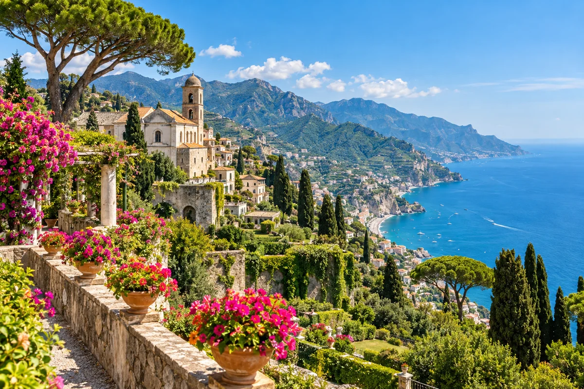
AI illustration inspired by Ravello. Ravello
Hilltop town above the coast, known for gardens (Villa Rufolo, Villa Cimbrone), the Ravello Festival and sweeping sea views. Its historic centre is a limited-traffic zone (ZTL).
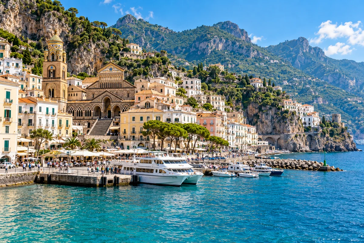
AI illustration inspired by Amalfi. Amalfi
The coast's central town and main ferry hub, with the landmark Cathedral of Sant'Andrea. The most convenient base for coastal connections.
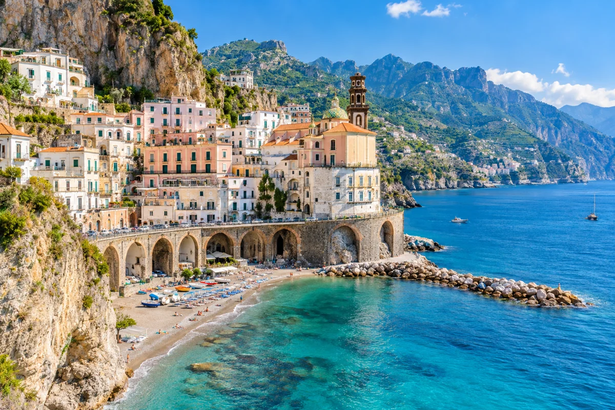
AI illustration inspired by Atrani. Atrani
The smallest town on the coast, a short walk east of Amalfi, with a quiet beach and a compact historic centre.
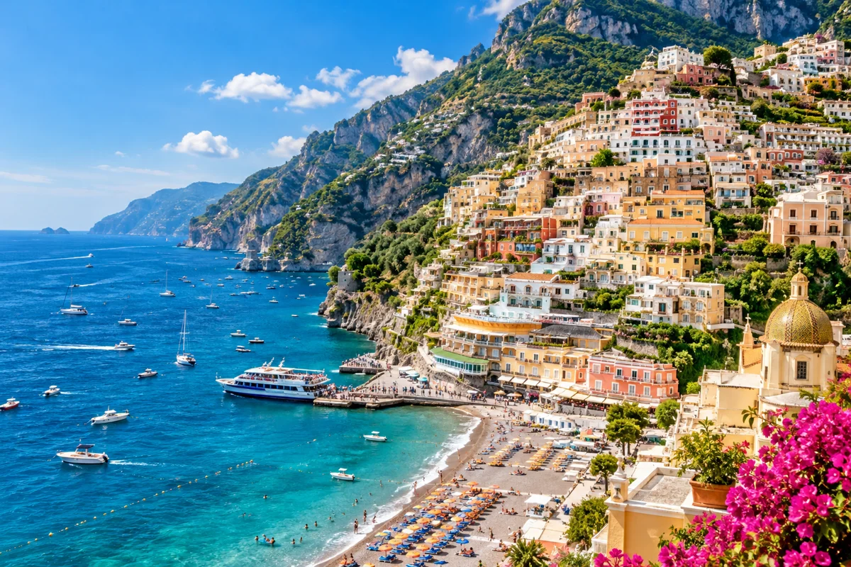
AI illustration inspired by Positano. Positano
The coast's most photographed town, with pastel houses tumbling to the sea, Spiaggia Grande beach and a seasonal ferry jetty. Car access and parking are very restricted.
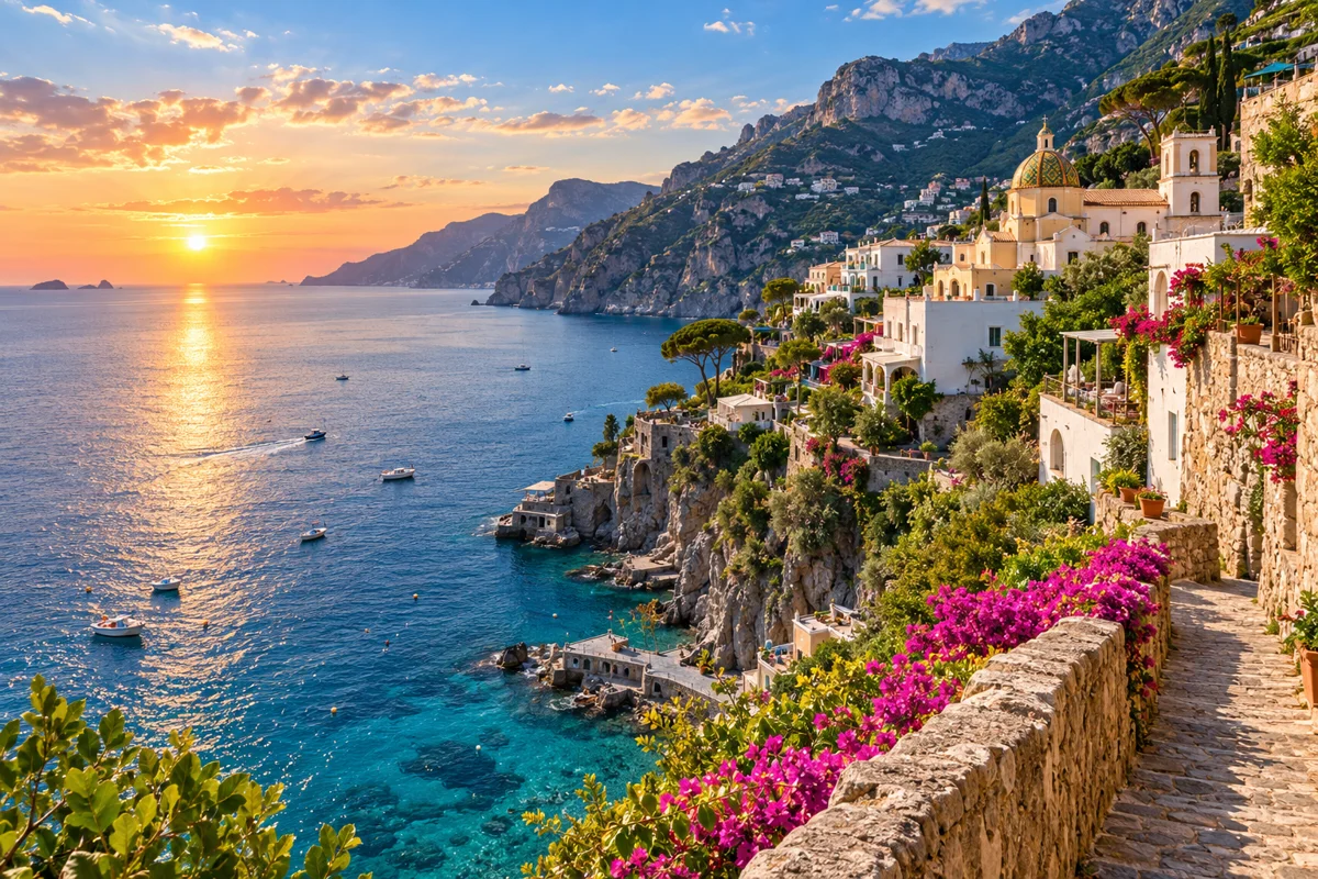
AI illustration inspired by Praiano. Praiano
A quieter town between Positano and Amalfi, known for sunsets and the start of several walking paths.

AI illustration inspired by Minori. Minori
A low-key seaside town east of Amalfi with a sandy beach and a seasonal ferry stop; known for traditional pasta and pastry.
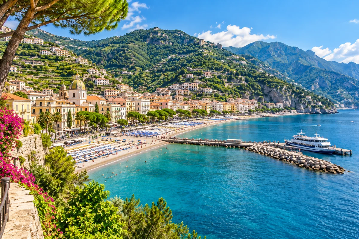
AI illustration inspired by Maiori. Maiori
Home to the coast's longest beach and a seasonal ferry port, with easier parking than the western towns.
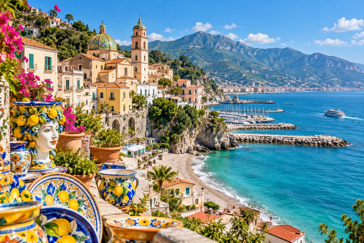
AI illustration inspired by Vietri sul Mare. Vietri sul Mare
The eastern gateway to the coast, famous for hand-painted ceramics and close to Salerno.
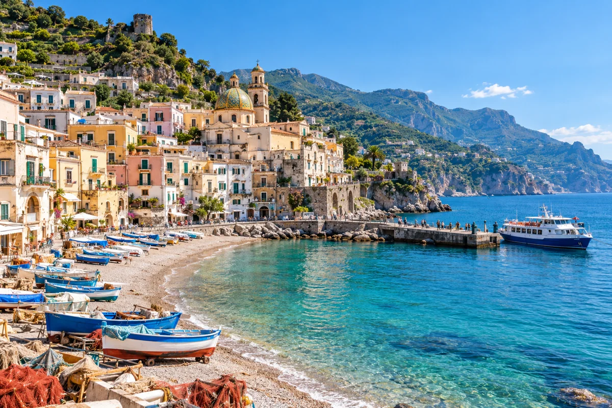
AI illustration inspired by Cetara. Cetara
A working fishing village known for tuna and colatura di alici (anchovy sauce), with a seasonal ferry stop.
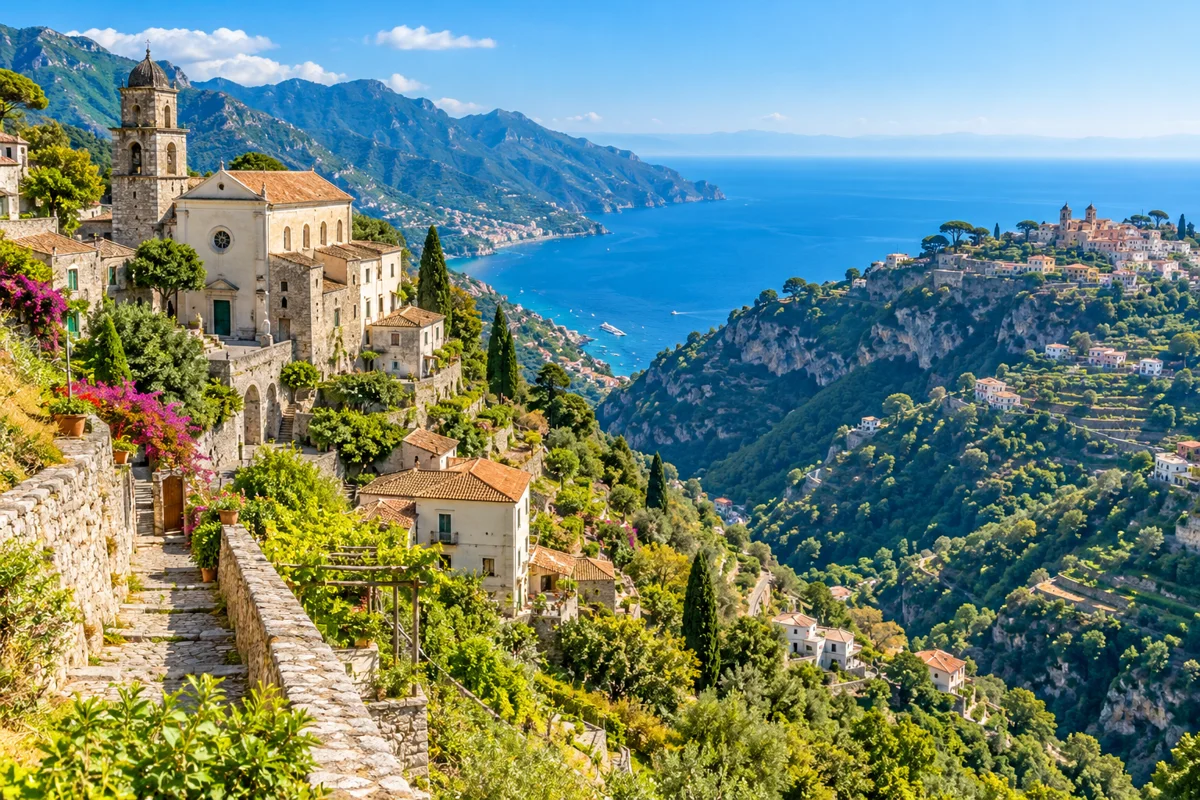
AI illustration inspired by Scala. Scala
The oldest settlement on the coast, facing Ravello across the valley, with quiet hamlets and walking routes.
Map of Ravello
Ravello sits above Amalfi and Atrani, a short drive up from the coast road — the inland marker between Amalfi and Minori on the map. Its highlights, Villa Rufolo and Villa Cimbrone, are a short walk from the pedestrian centre (a limited-traffic zone), so cars use the Auditorium car park on Via della Repubblica. See Amalfi to Ravello and things to do in Ravello.
Beaches on the coast, Capri and Ischia
The coast's beaches are mostly small coves and town beaches. See the full guide to Amalfi Coast beaches.
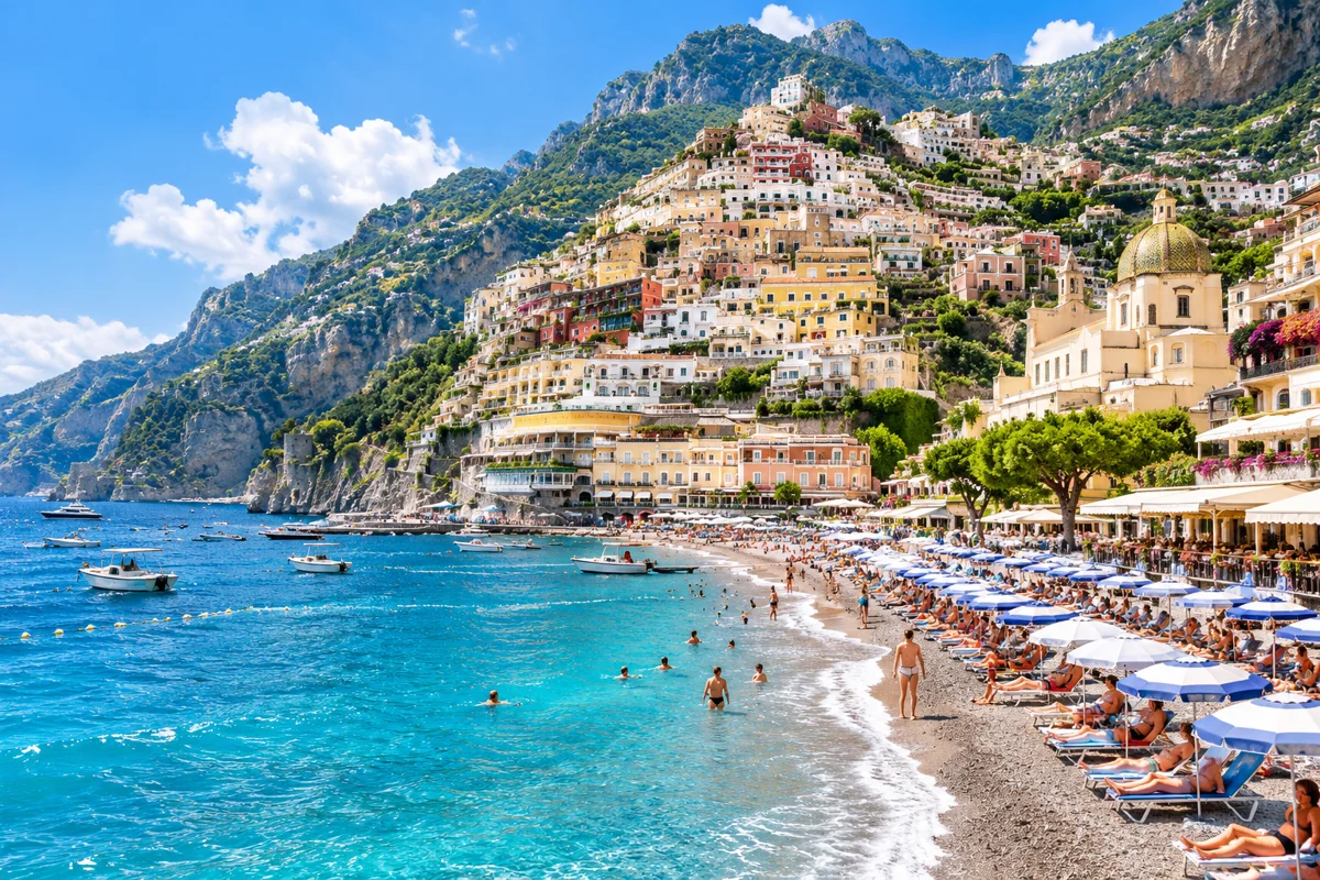
AI illustration inspired by Spiaggia Grande. Spiaggia Grande
Positano's main beach below the pastel houses, lined with sunbeds and restaurants; busy in summer. Positano
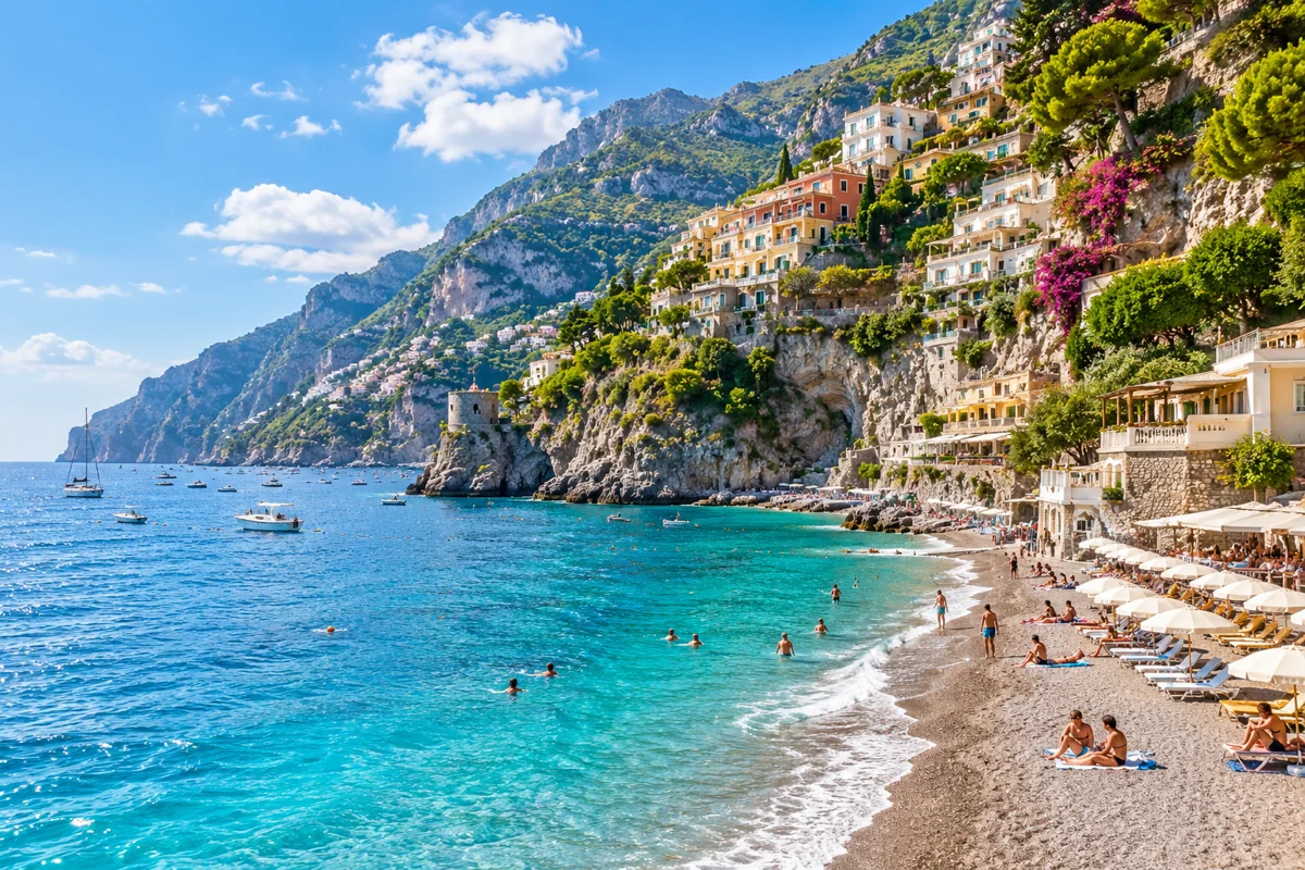
AI illustration inspired by Fornillo Beach. Fornillo Beach
A quieter beach a short walk west of Spiaggia Grande, reached by a seafront path. Positano
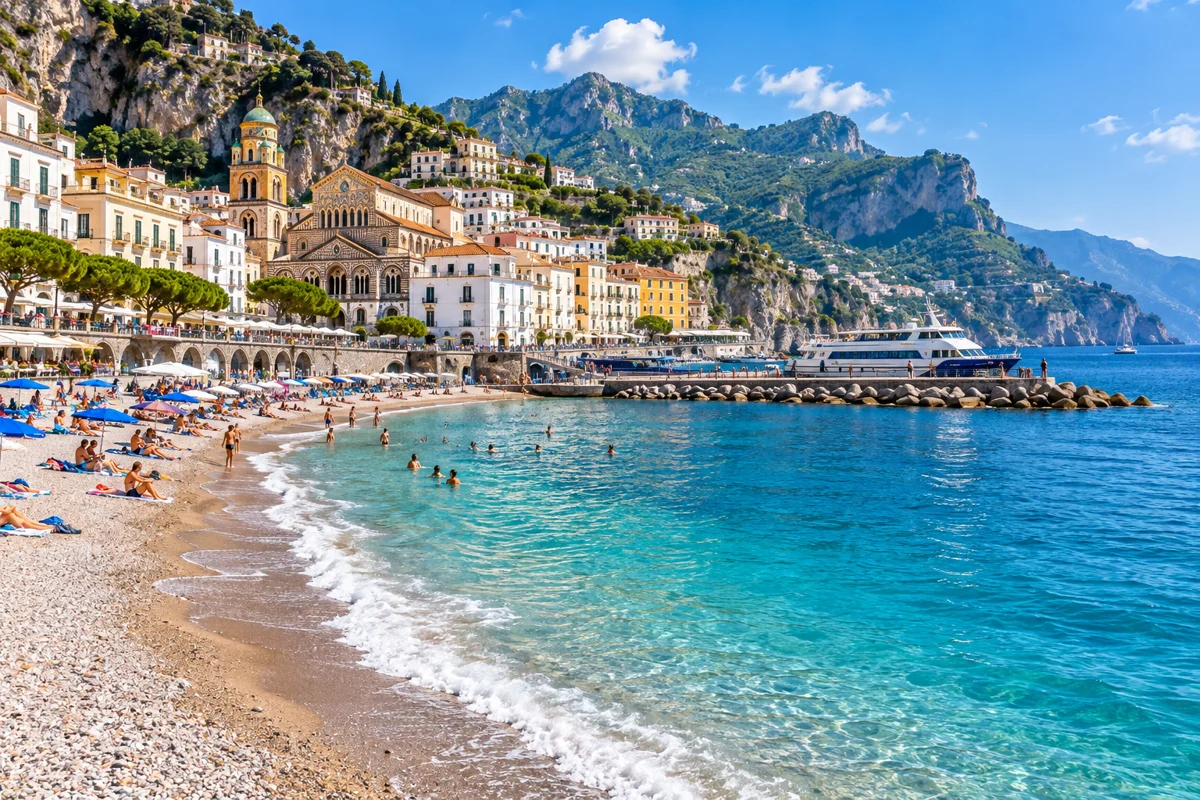
AI illustration inspired by Marina Grande (Amalfi). Marina Grande (Amalfi)
Amalfi's town beach beside the ferry port, with sand and pebble areas and easy access. Amalfi
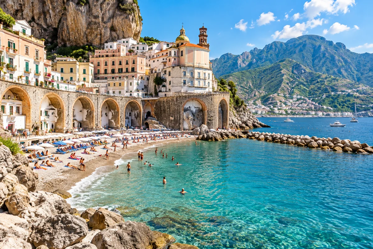
AI illustration inspired by Atrani Beach. Atrani Beach
A small, local-feeling beach in Atrani, a short walk from Amalfi. Atrani
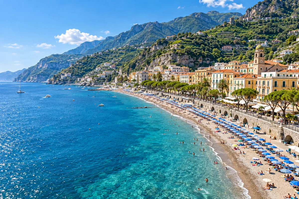
AI illustration inspired by Maiori Beach. Maiori Beach
The longest beach on the Amalfi Coast, with the most space and easier parking than the western towns. Maiori
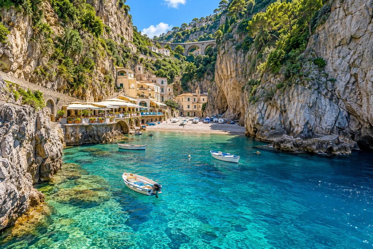
AI illustration inspired by Marina di Praia. Marina di Praia
A tiny cove beach set in a cleft between cliffs near Praiano, with a few restaurants. Praiano
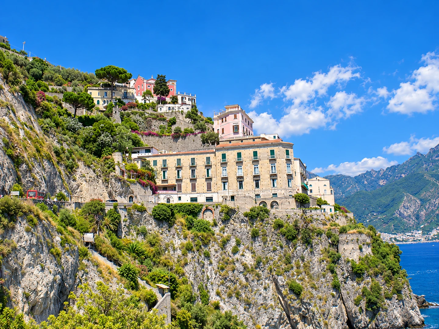
AI-enhanced photo · original: Geofix · CC BY-SA 3.0. AI-enhanced lighting, colour and detail, based on the credited original; resized to WebP. Not evidence of current conditions. Castiglione di Ravello (Ravello Mare)
Ravello’s seaside beach beside Atrani, enclosed by cliffs. Access from the SS163 is via a long staircase of around 200 steps; shade reaches the beach earlier than on open shores. This is Ravello Mare, below the hilltop town. Ravello
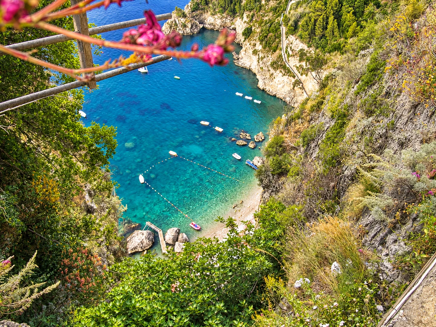
AI-enhanced photo · original: No machine-readable author provided. Sudodana2048 assumed (based on copyright claims). · CC BY-SA 3.0. AI-enhanced lighting, colour and detail, based on the credited original; resized to WebP. Not evidence of current conditions. Santa Croce beach
A small beach below Vettica Minore, west of Amalfi. Plan access by boat and confirm the return service and sea conditions with the operator; do not assume a road or pedestrian route reaches the sand. Amalfi
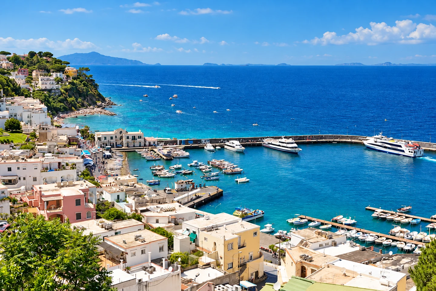
AI-enhanced photo · original: Ekrem Canli · CC BY-SA 4.0. AI-enhanced lighting, colour and detail, based on the credited original; resized to WebP. Not evidence of current conditions. Marina Grande beach — Capri
Pebble beach west of Capri’s main port, convenient for a swim near the arrival area. Public sections and beach clubs share the waterfront. Capri
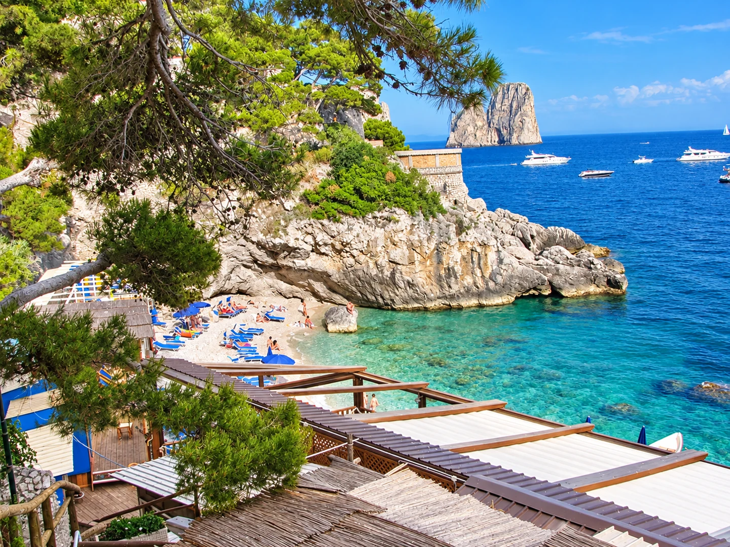
AI-enhanced photo · original: Bicloch · CC BY 3.0. AI-enhanced lighting, colour and detail, based on the credited original; resized to WebP. Not evidence of current conditions. Marina Piccola — Capri
Small pebble coves on Capri’s southern shore with views towards the Faraglioni. Reach the bay from Capri town; check whether Via Krupp is open before choosing that walking route. Capri
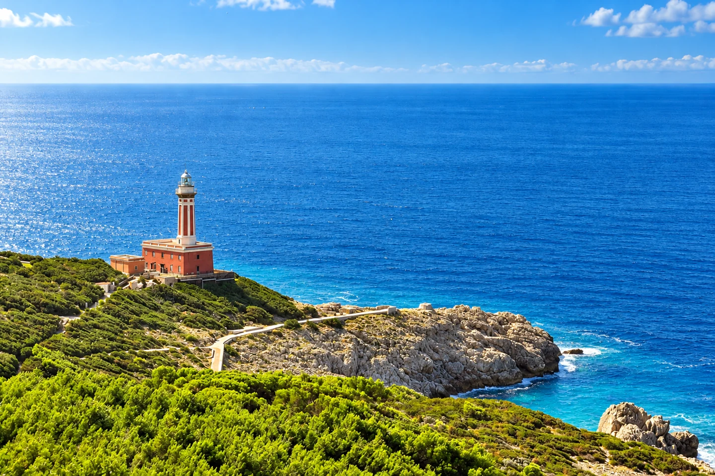
AI-enhanced photo · original: Dr Tr from Saint-Petersburg, Russia · CC BY 2.0. AI-enhanced lighting, colour and detail, based on the credited original; resized to WebP. Not evidence of current conditions. Punta Carena swimming rocks
Rocky bathing area near the lighthouse, rather than a sandy beach. Sea entry is from rocks and platforms; exposed conditions can make swimming unsuitable. Anacapri, Capri
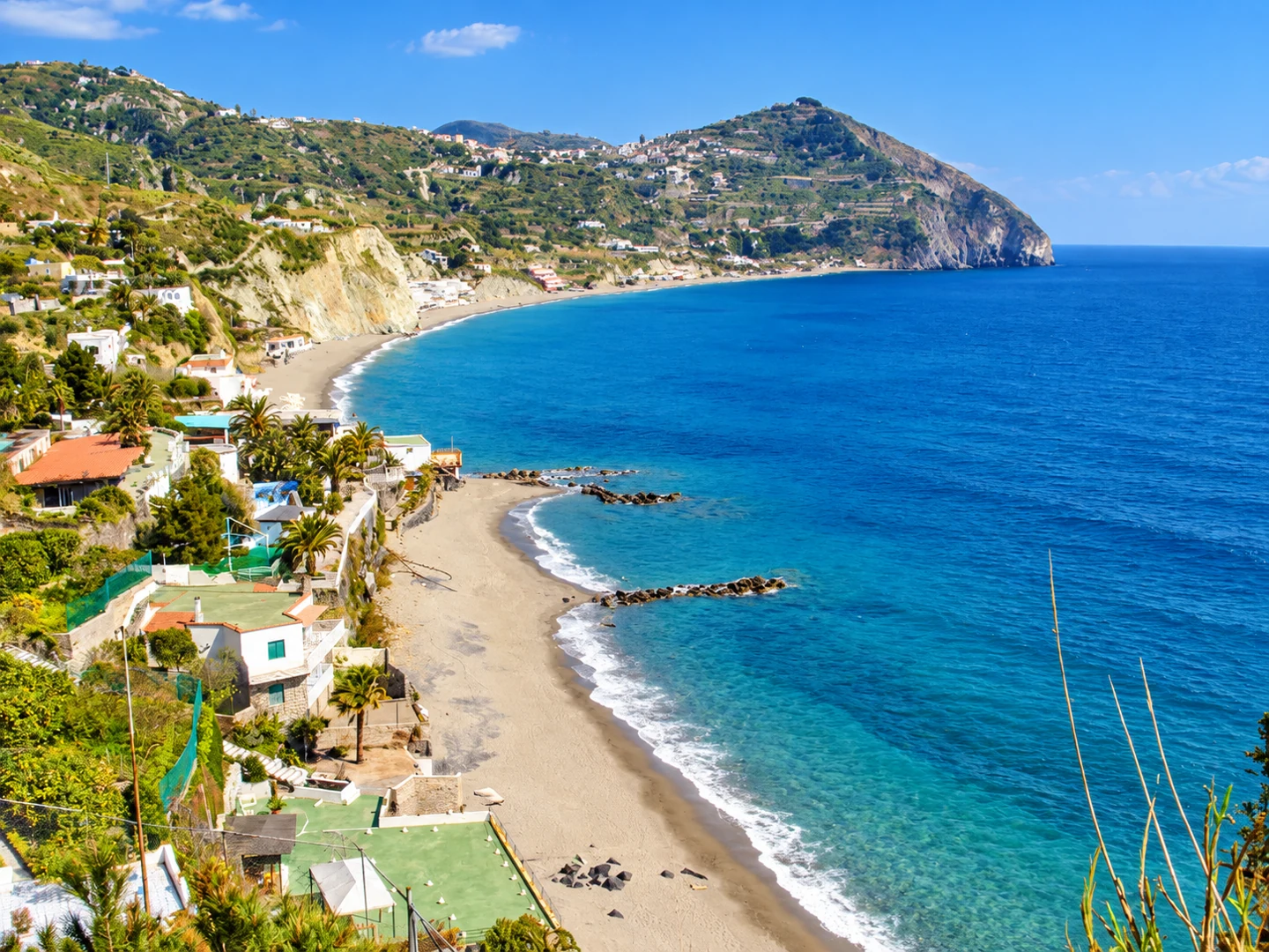
AI-enhanced photo · original: Grauesel · CC BY-SA 3.0. AI-enhanced lighting, colour and detail, based on the credited original; resized to WebP. Not evidence of current conditions. Maronti beach
A long sandy shoreline on southern Ischia, between Barano and Sant’Angelo. Choose an access point before setting out: the shoreline extends well beyond the main road entrance. Barano, Ischia

AI-enhanced photo · original: Abxbay · CC BY-SA 4.0. AI-enhanced lighting, colour and detail, based on the credited original; resized to WebP. Not evidence of current conditions. Citara beach
Beach on Ischia’s southwestern coast near Forio, with both free areas and equipped bathing establishments. The pin follows the access location published by the municipality. Forio, Ischia
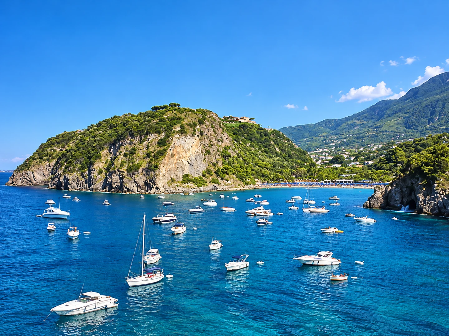
AI-enhanced photo · original: Vito Calise · Public domain. AI-enhanced lighting, colour and detail, based on the credited original; resized to WebP. Not evidence of current conditions. San Montano bay
Sheltered bay between the Monte Vico and Zaro headlands. Beach access and thermal-park admission are separate: confirm the facilities you want before booking. Lacco Ameno, Ischia
Parking on the Amalfi Coast
Town centres are limited-traffic zones, so drivers use paid garages and lots and walk in. Verified by name and address below; rates and seasonal opening change, so confirm with the operator. See driving & parking.
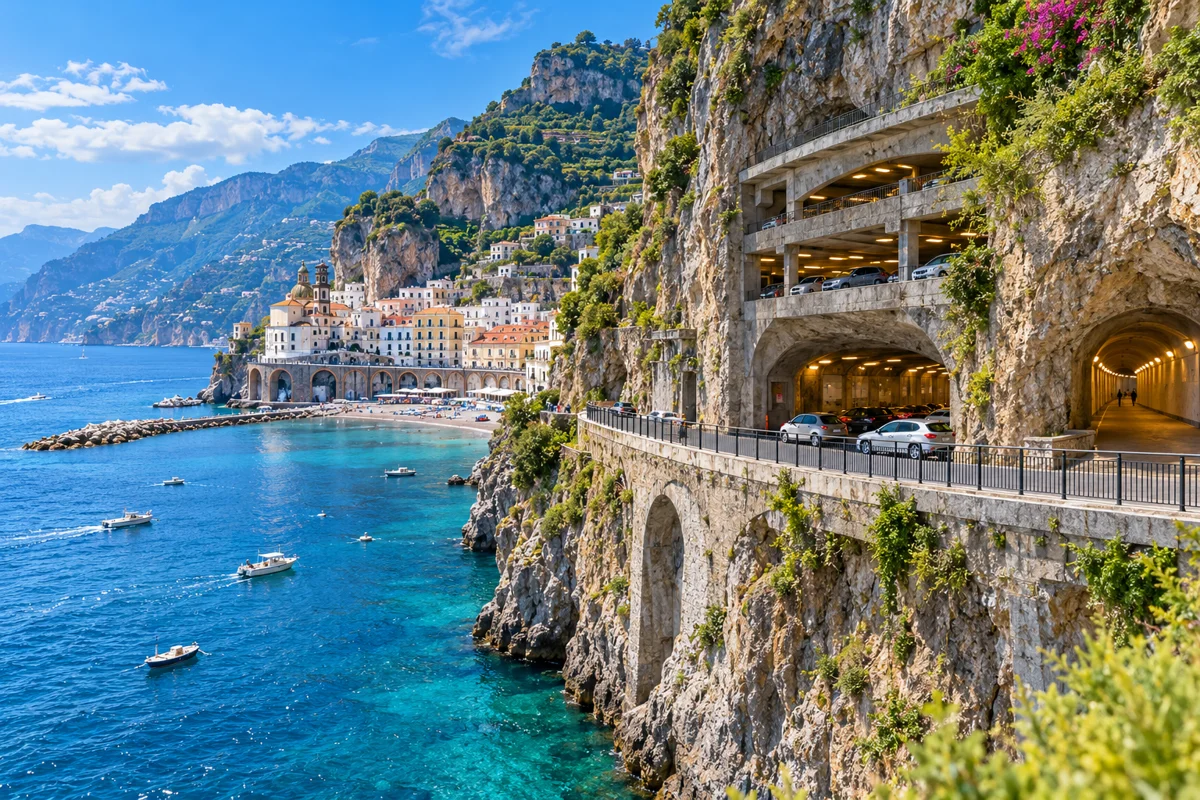
AI illustration inspired by Parcheggio Luna Rossa. Parcheggio Luna Rossa
Public paid garage carved into the cliff on the Atrani side of Amalfi, linked to the centre by a pedestrian tunnel. Operated by Amalfi Mobilità. Rates change seasonally — confirm on arrival.
Via Pantaleone Comite 35, 84011 Amalfi (SA)
Source · reviewed 2026-10-11 · location approximate
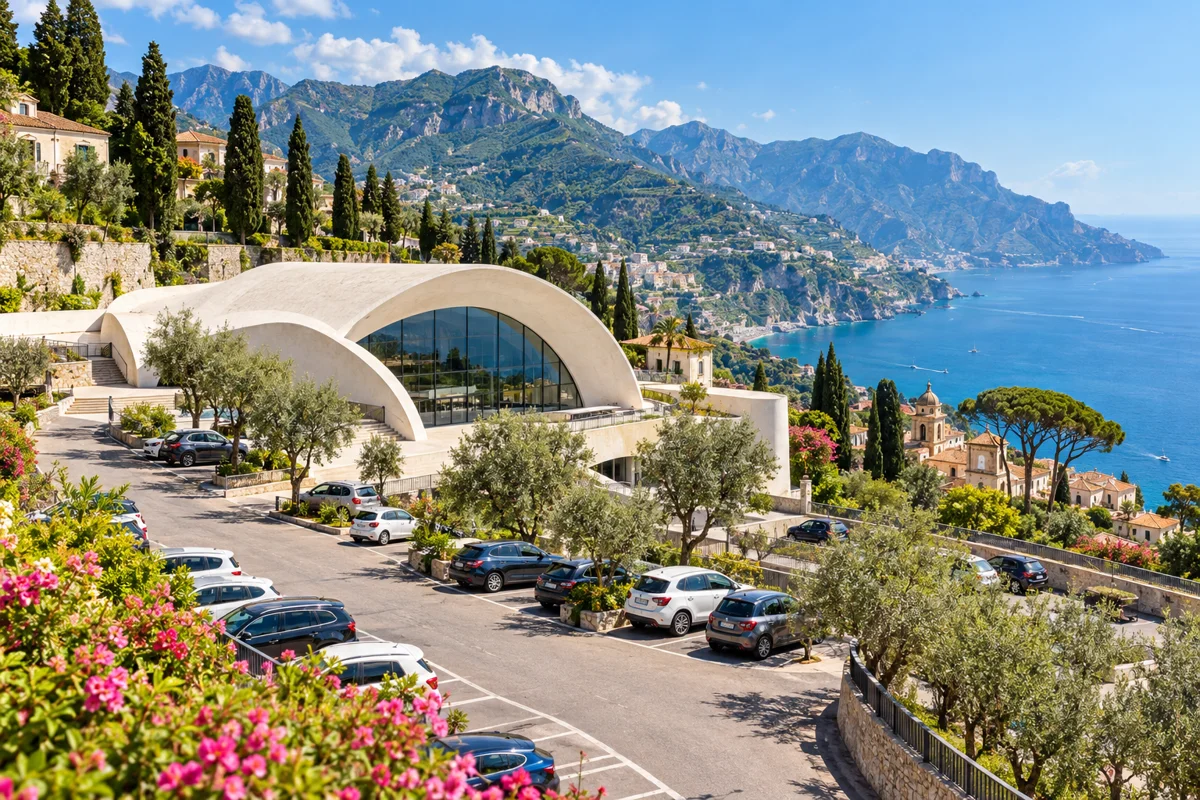
AI illustration inspired by Ravello Auditorium car park (Oscar Niemeyer). Ravello Auditorium car park (Oscar Niemeyer)
Seasonal paid parking on Via della Repubblica, on the approach to Ravello's ZTL centre, with a shuttle in high season. Typically open April–October — confirm before relying on it.
Via della Repubblica, 84010 Ravello (SA)
Source · reviewed 2026-10-11 · location approximate
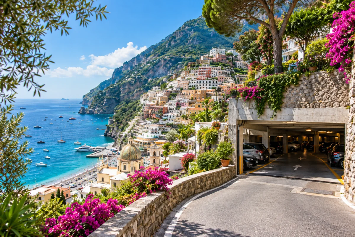
AI illustration inspired by Parcheggio Mandara. Parcheggio Mandara
One of the closest paid garages to Positano's pedestrian centre near Piazza dei Mulini. Parking in Positano is limited and expensive; gates may close in the evening — confirm hours and rates directly.
Near Piazza dei Mulini / Viale Pasitea, 84017 Positano (SA)
Source · reviewed 2026-10-11 · location approximate
Ferry ports on the map
Ferries are often the easiest way between the main towns in season (roughly April–October). Check current timetables and fares with the operator. See getting around the Amalfi Coast.
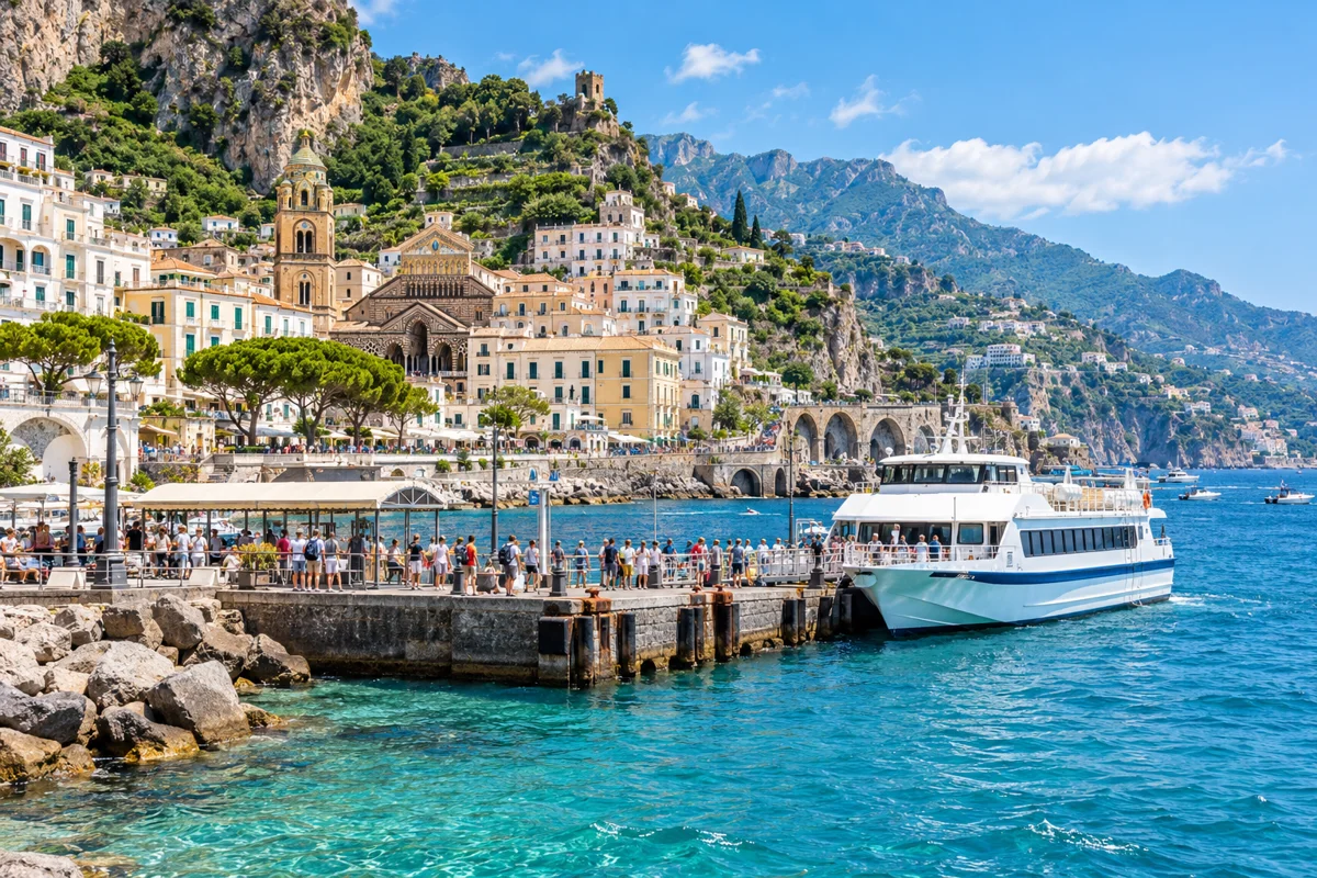
AI illustration inspired by Amalfi ferry terminal. Amalfi ferry terminal
The coast's main ferry hub (Molo Cassone, Via Lungomare dei Cavalieri), with seasonal foot-passenger connections to Positano, Salerno, Minori, Maiori and Cetara. Services run roughly April–October.
Operator · reviewed 2026-10-11
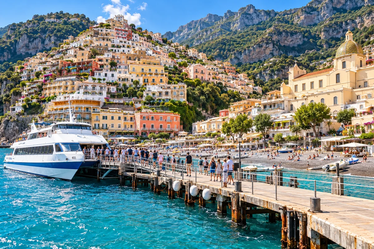
AI illustration inspired by Positano ferry jetty. Positano ferry jetty
Seasonal ferry jetty at Spiaggia Grande, with foot-passenger connections to Amalfi, Salerno and Capri in season. No winter service.
Operator · reviewed 2026-10-11
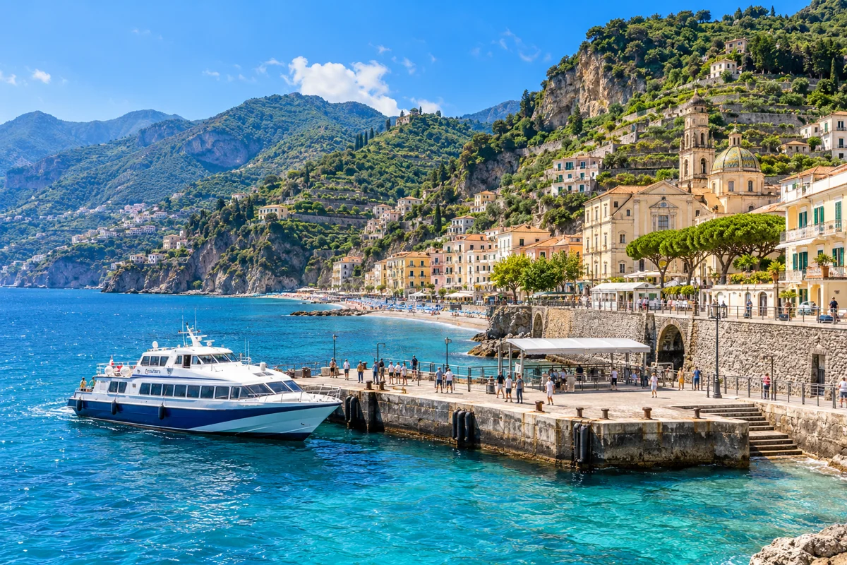
AI illustration inspired by Minori port. Minori port
Seasonal hydrofoil/ferry stop east of Amalfi, with connections toward Salerno and Amalfi in summer.
Operator · reviewed 2026-10-11
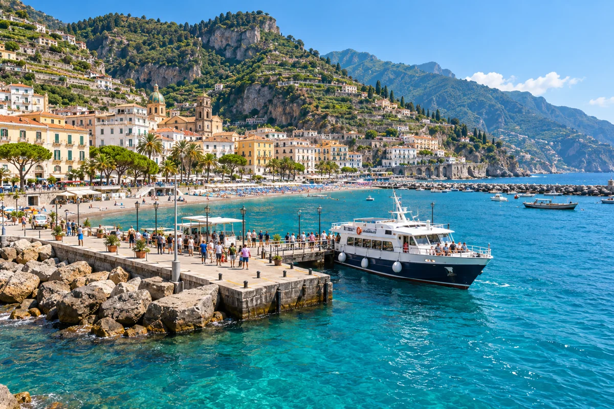
AI illustration inspired by Maiori port. Maiori port
Seasonal ferry port with summer connections along the coast and to Salerno.
Operator · reviewed 2026-10-11
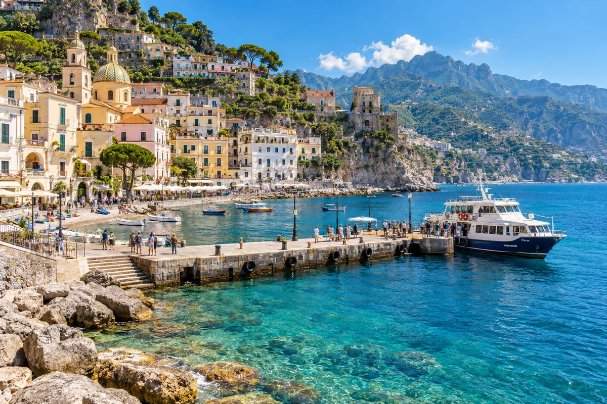
AI illustration inspired by Cetara port. Cetara port
Small seasonal ferry stop served by Travelmar in summer between Salerno and Amalfi.
Operator · reviewed 2026-10-11
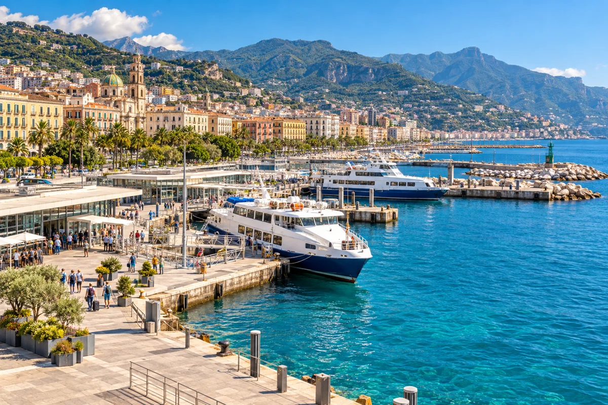
AI illustration inspired by Salerno ferry terminal. Salerno ferry terminal
The main mainland gateway for Amalfi Coast ferries. Travelmar sailings to Minori/Amalfi use Piazza Concordia; other operators use Molo Manfredi/Molo Masuccio.
Operator · reviewed 2026-10-11
Things to do on the map
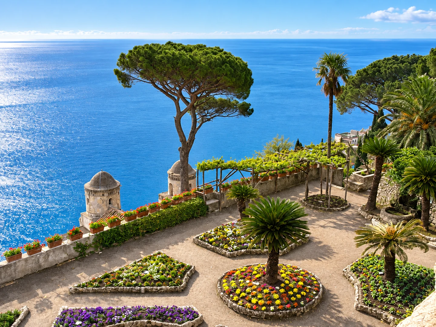
AI-enhanced photo · original: Rinina25 & Twice25 · CC BY 2.5. AI-enhanced lighting, colour and detail, based on the credited original; resized to WebP. Not evidence of current conditions. Villa Rufolo
13th-century villa and terraced gardens in Ravello, the main stage of the Ravello Festival, overlooking the Gulf of Salerno.
Explore Villa Rufolo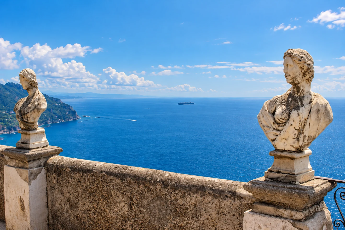
AI-enhanced photo · original: Miguel Hermoso Cuesta · CC BY-SA 4.0. AI-enhanced lighting, colour and detail, based on the credited original; resized to WebP. Not evidence of current conditions. Villa Cimbrone
Historic villa and gardens in Ravello, famous for the Terrace of Infinity and its clifftop views.
Explore Villa Cimbrone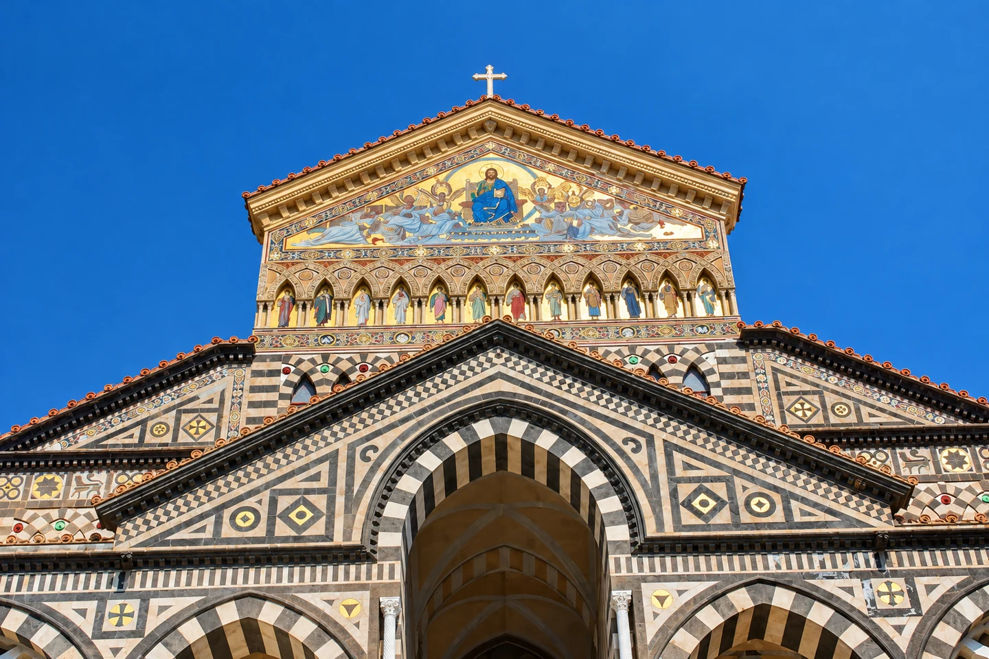
AI-enhanced photo · original: Miguel Hermoso Cuesta · CC BY-SA 4.0. AI-enhanced lighting, colour and detail, based on the credited original; resized to WebP. Not evidence of current conditions. Amalfi Cathedral (Duomo di Sant'Andrea)
The 9th-century cathedral dominating Amalfi's main square, reached by a monumental staircase, with the Cloister of Paradise alongside.
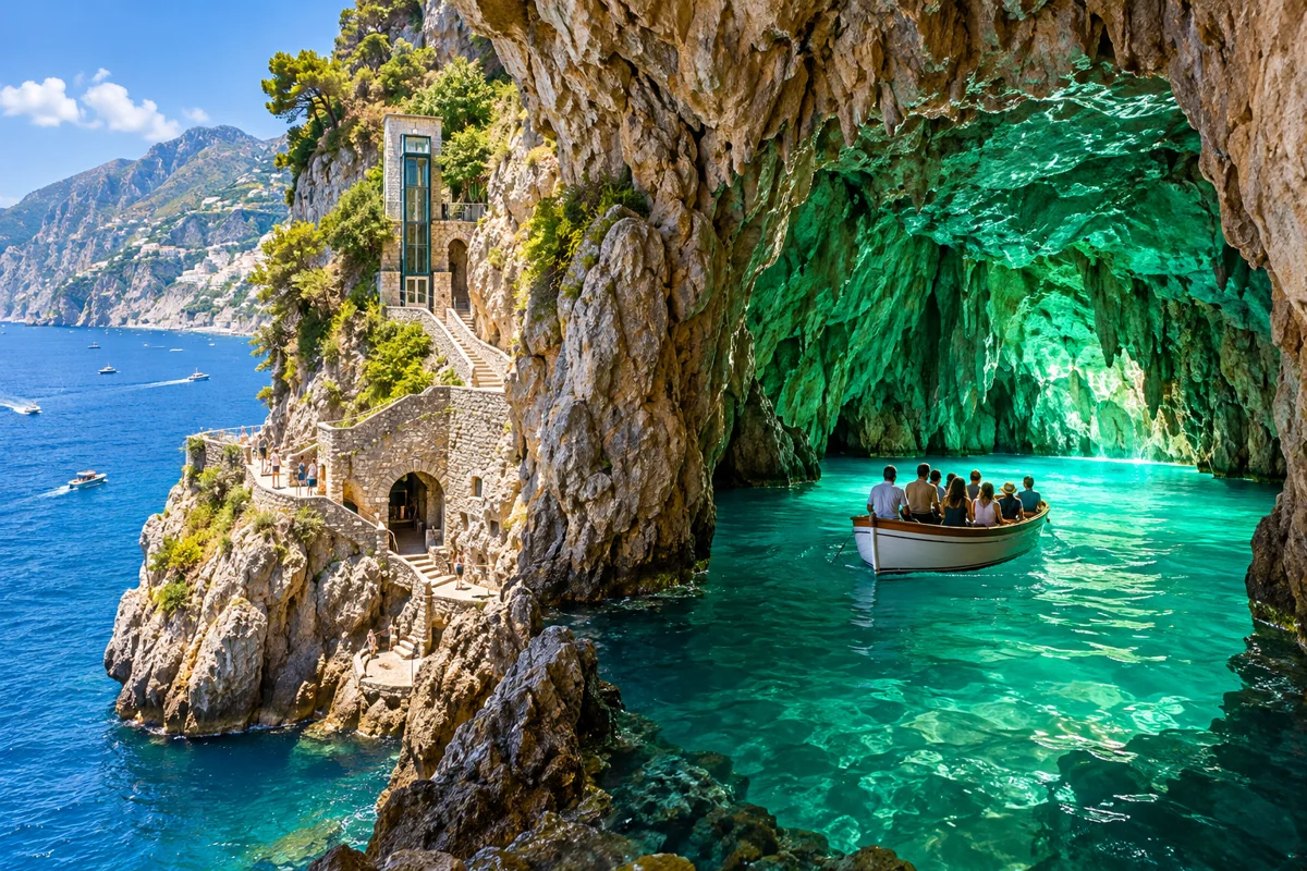
AI illustration inspired by Emerald Grotto (Grotta dello Smeraldo). Emerald Grotto (Grotta dello Smeraldo)
A sea cave near Conca dei Marini where light turns the water emerald green; visited by small boat or by lift from the coast road.
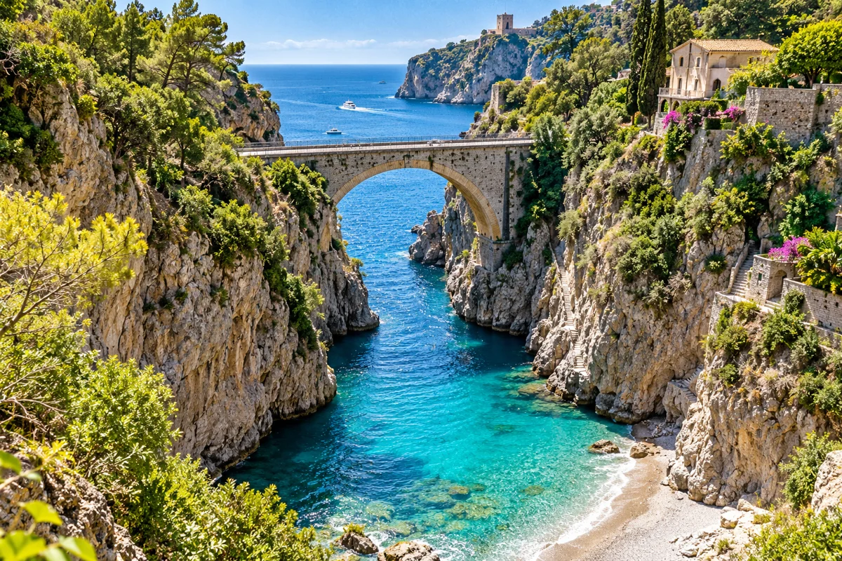
AI illustration inspired by Fiordo di Furore. Fiordo di Furore
A dramatic fjord-like inlet spanned by a high road bridge, between Praiano and Conca dei Marini.
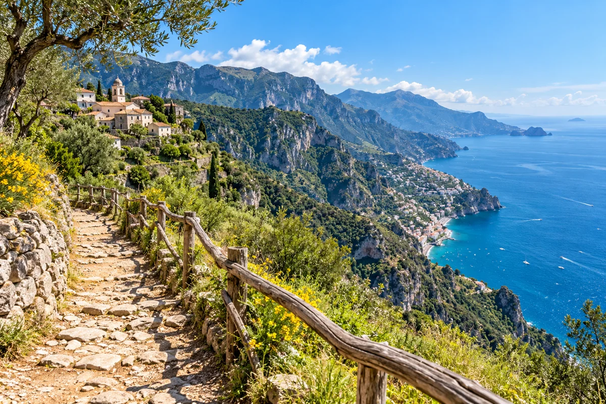
AI illustration inspired by Path of the Gods — Bomerano trailhead. Path of the Gods — Bomerano trailhead
The usual (higher, easier) start of the Path of the Gods walk in Bomerano, Agerola, descending west toward Nocelle and Positano.
Explore Path of the Gods — Bomerano trailhead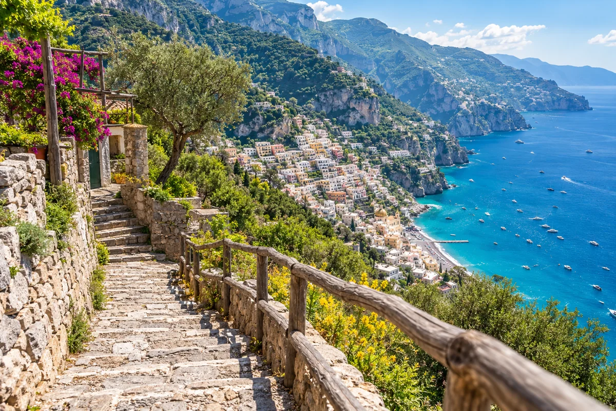
AI illustration inspired by Path of the Gods — Nocelle end. Path of the Gods — Nocelle end
The western end of the Path of the Gods above Positano at Nocelle, from where steps descend toward Positano.
Explore Path of the Gods — Nocelle end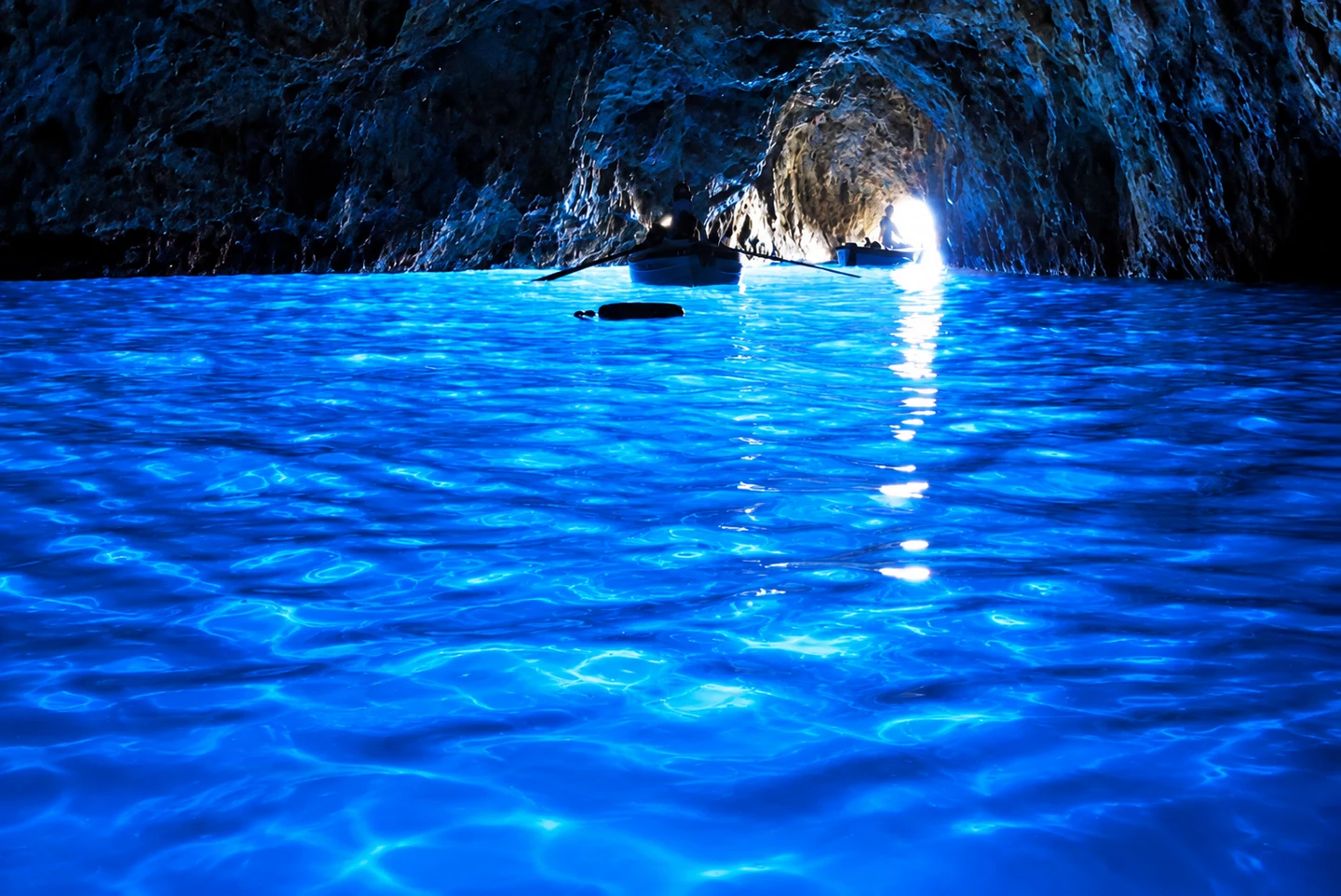
AI-enhanced photo · original: Glen Scarborough · CC BY-SA 2.0. AI-enhanced lighting, colour and detail, based on the credited original; resized to WebP. Not evidence of current conditions. Grotta Azzurra — Blue Grotto
Sea cave visited in small boats when sea and tide conditions permit. Entry can close at short notice; check the official visitor information before travelling.
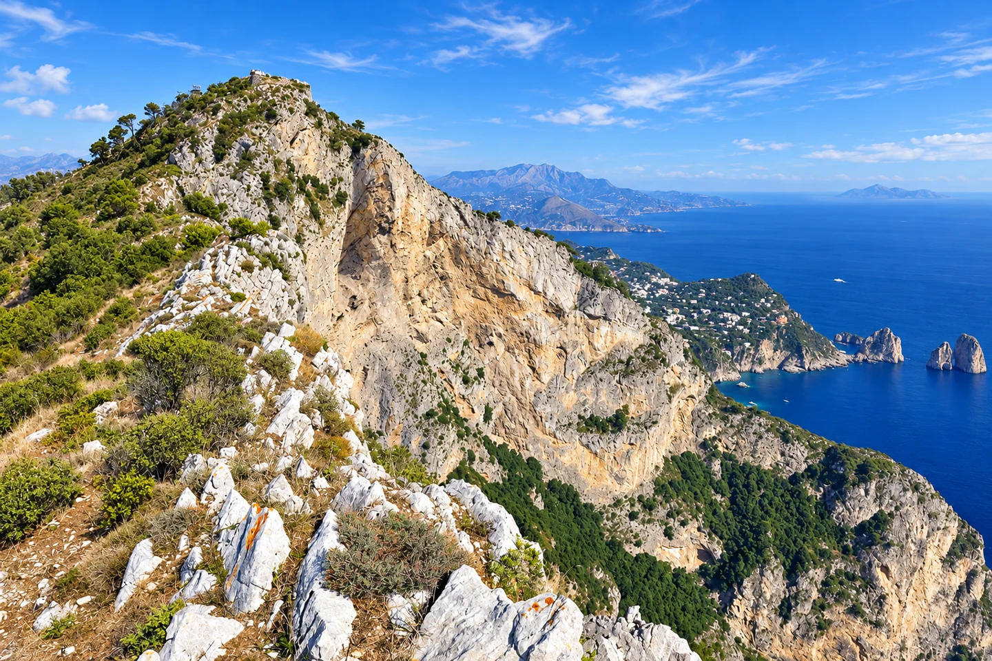
AI-enhanced photo · original: Falk2 · CC BY-SA 4.0. AI-enhanced lighting, colour and detail, based on the credited original; resized to WebP. Not evidence of current conditions. Monte Solaro
Capri’s high viewpoint, reached by chairlift from Anacapri or on foot. The pin marks the summit, not the lower chairlift station.
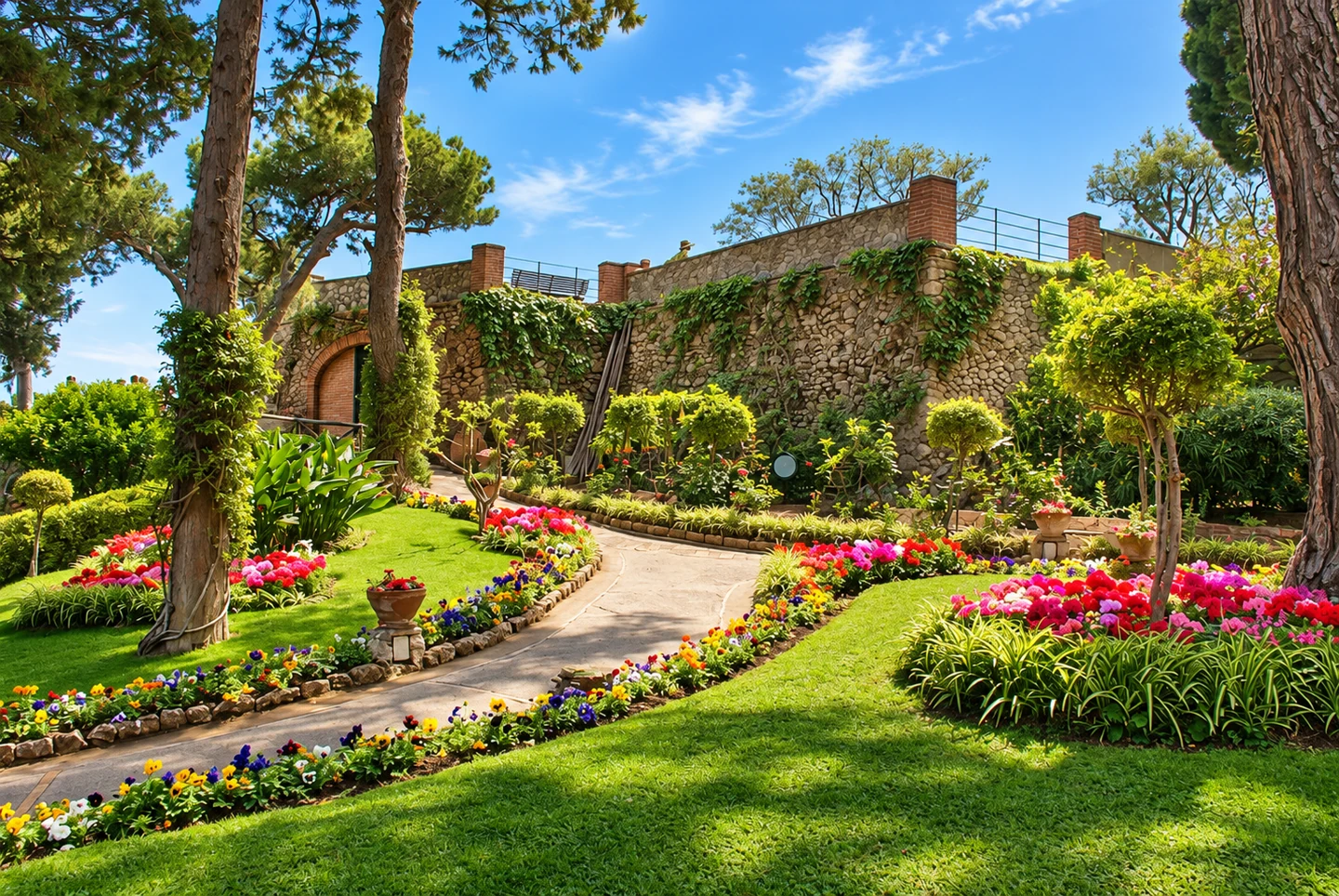
AI-enhanced photo · original: Norberto Chavez-Tapia · CC BY-SA 2.0. AI-enhanced lighting, colour and detail, based on the credited original; resized to WebP. Not evidence of current conditions. Giardini di Augusto
Terraced gardens near central Capri overlooking the Faraglioni and Via Krupp. A good viewpoint stop; garden entry does not establish whether the path below is open.
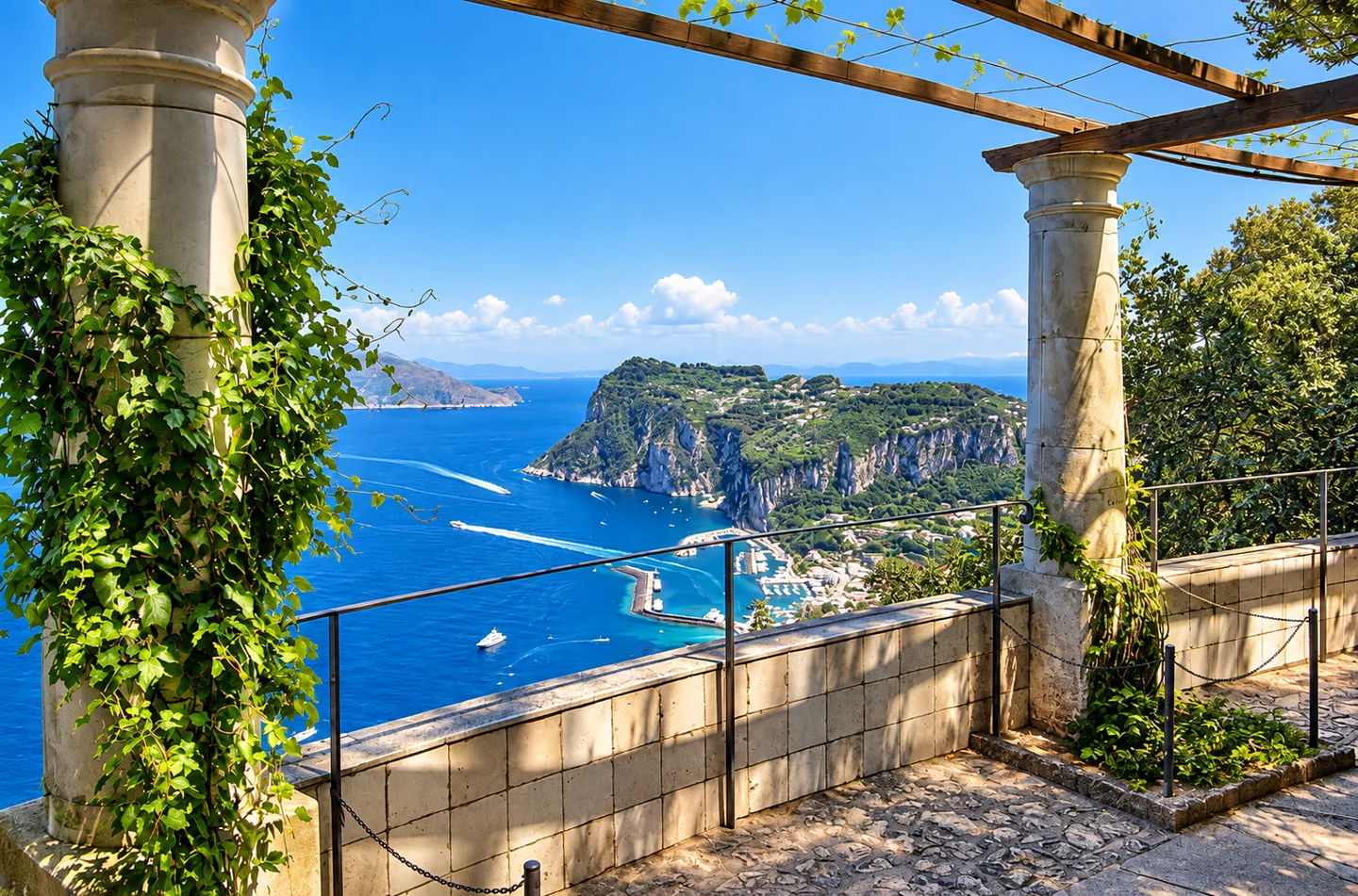
AI-enhanced photo · original: Berthold Werner · CC BY-SA 3.0. AI-enhanced lighting, colour and detail, based on the credited original; resized to WebP. Not evidence of current conditions. Villa San Michele
Axel Munthe’s house museum and garden in Anacapri, with views over Marina Grande. Check museum opening and admission directly with Villa San Michele.
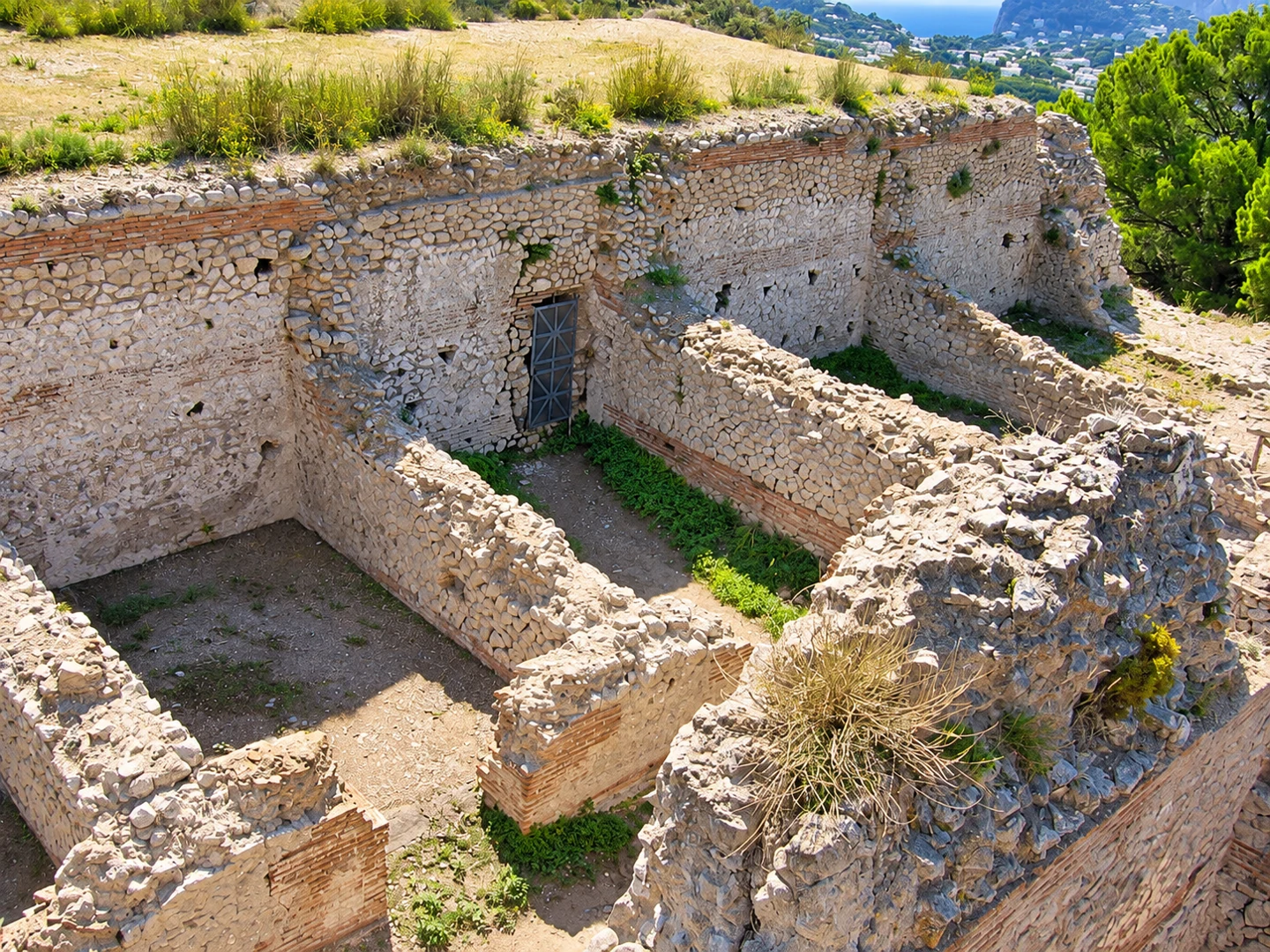
AI-enhanced photo · original: No machine-readable author provided. Buckeye~commonswiki assumed (based on copyright claims). · CC BY-SA 3.0. AI-enhanced lighting, colour and detail, based on the credited original; resized to WebP. Not evidence of current conditions. Villa Jovis
Roman imperial villa ruins on Capri’s eastern heights. Reaching the site involves an uphill walk; confirm opening before making the climb.
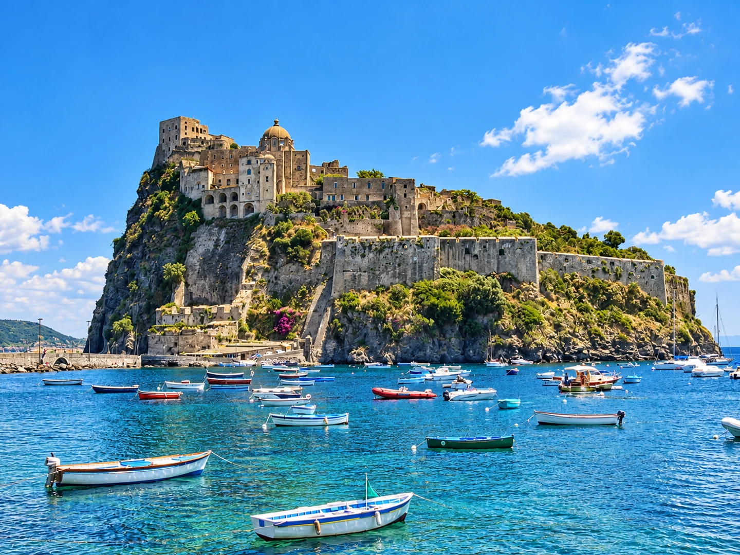
AI-enhanced photo · original: Wikimedia Commons contributor · CC BY-SA 3.0. AI-enhanced lighting, colour and detail, based on the credited original; resized to WebP. Not evidence of current conditions. Castello Aragonese
Historic castle complex on the rocky islet connected to Ischia Ponte. Allow time for paths, terraces and views, and check the official visiting information.
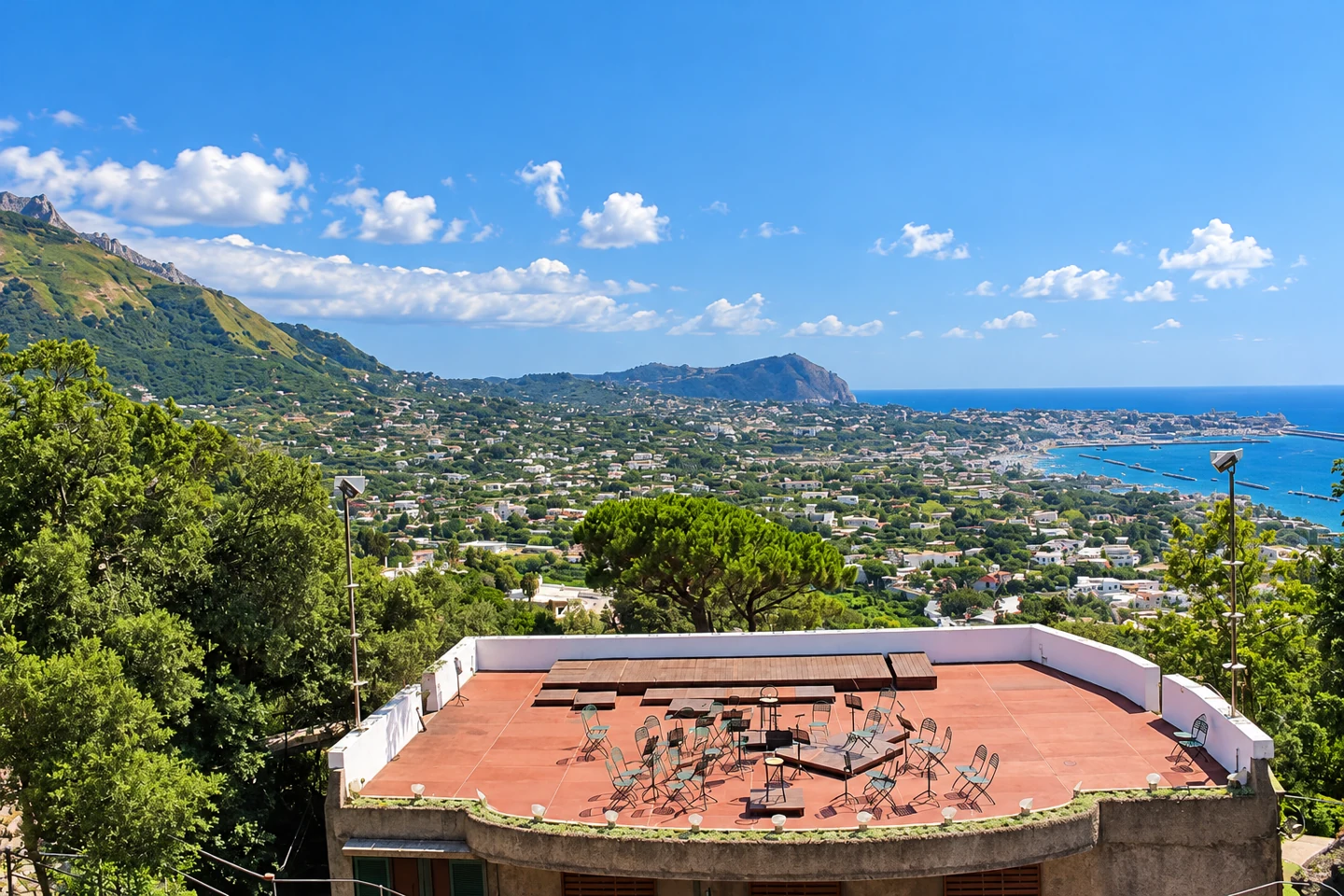
AI-enhanced photo · original: Miguel Hermoso Cuesta · CC BY-SA 4.0. AI-enhanced lighting, colour and detail, based on the credited original; resized to WebP. Not evidence of current conditions. Giardini La Mortella
Botanical gardens created by Susana Walton in Forio, with planted terraces and paths. Opening days and concert admission should be checked with the garden.

AI-enhanced photo · original: Roberto De Martino · Public domain. AI-enhanced lighting, colour and detail, based on the credited original; resized to WebP. Not evidence of current conditions. Monte Epomeo
Mountain viewpoint in the centre of Ischia. The pin marks the summit: plan a walking route and appropriate footwear rather than following driving directions to the marker.
Exploring the coast from Ravello?

Villa Mansi offers independent sea-view suites below Ravello's hilltop centre, between Ravello, Atrani and Amalfi — with free private covered parking (uncommon on the coast) and easy access to Amalfi's ferry port for day trips. Access involves approximately 100 steps.
Check availabilitySea-view suitesWhole-villa optionWhere to stay in Ravello
SITA bus stops on the Amalfi Coast
Enable SITA stops and choose a line, or search by stop name or code. This map contains 456 unique stop IDs from the official SITA Sud NeTEx dataset for lines 5010, 5020, 5070, 5080, 5081, 5110, 5120, 5130 within the coastal corridor and nearby connections (Sorrento, Salerno, Ravello, Scala, Agerola and Tramonti). Stops on extensions outside this area are excluded.
Coordinates are reproduced from the operator dataset, not measured roadside. Some IDs represent both directions: check the destination and the correct side of the road. This is a stop-location map, not live departures. Dataset validity: 2026-10-01 to 2026-10-31. Check current SITA timetables and notices.
All 456 SITA stops in this map
- Agerola (Bomerano) — Bomerano · 5080 · 40.626600, 14.545100
- Agerola (S. Lazzaro) — S.Lazzaro · 5080 · 40.625200, 14.567400
- Agerola Pianillo — 401003 · 5080 · 40.639400, 14.544500
- Agerola Santa Maria — 401005 · 5080 · 40.642200, 14.544100
- Agerola Traforo — 401006 · 5080 · 40.648400, 14.543800
- Amalfi — Amalfi · 5020, 5070, 5080, 5110, 5120, 5130 · 40.633500, 14.602100
- Amalfi Pastena — 504003 · 5120 · 40.629700, 14.589600
- Angolo via Zia Marta — RAV006 · 5110 · 40.640700, 14.614200
- Atrani — 508001 · 5020, 5110, 5120, 5130 · 40.635800, 14.608900
- B&B La Bellavista — 508205 · 5080 · 40.619300, 14.561800
- Bivio Capitignano — 582038 · 5010 · 40.699700, 14.622100
- Bivio Cesarano — 582010 · 5010 · 40.702000, 14.612200
- Bivio Conca — 526002 · 5080 · 40.620800, 14.576900
- Bivio Gete — 582018 · 5010 · 40.696100, 14.648100
- Bivio Lone — 504008 · 5070, 5080, 5120 · 40.625500, 14.585800
- Bivio Marciano — SITAP095 · 5070 · 40.603500, 14.344100
- Bivio Montepertuso — SITAP106 · 5070 · 40.630000, 14.477400
- Bivio Monticchio — 407023 · 5070 · 40.595400, 14.355900
- Bivio Novella — 582015 · 5010 · 40.685500, 14.642700
- Bivio Pendolo — 582016 · 5010 · 40.687200, 14.642500
- Bivio Polvica — 582002 · 5010 · 40.690800, 14.645700
- Bivio Pontone — SCA019 · 5110 · 40.644800, 14.608400
- Bivio Raito — 586002 · 5020, 5120, 5130 · 40.672600, 14.724800
- Bivio Ravello — Bv.Ravello · 5020, 5110, 5120, 5130 · 40.638200, 14.612700
- Bivio San Francesco — 407018 · 5070 · 40.607800, 14.347000
- Bivio Sant`Agata — 407017 · 5070 · 40.608700, 14.380300
- Bivio Schiazzano — SITAP057 · 5070 · 40.603900, 14.349000
- Bivio Titigliano — 407014 · 5070 · 40.603900, 14.357100
- Bivio Tovere — 508134 · 5080 · 40.620800, 14.560600
- Bivio Vettica — 504007 · 5080, 5120 · 40.628400, 14.582900
- Breccelle — 582025 · 5010 · 40.716800, 14.633700
- C.so S.Agata — 407051 · 5070 · 40.605500, 14.374500
- Cala Le Fontanelle — 407032 · 5070 · 40.597300, 14.332600
- Calata Puolo — SITAP093 · 5070 · 40.627600, 14.354200
- Campidoglio — SCA003 · 5110 · 40.652900, 14.604200
- Campinola — 582005 · 5010 · 40.699100, 14.647500
- Campo Sportivo (Pietre) — 582039 · 5010 · 40.702200, 14.621100
- Campora — 508170 · 5080 · 40.643700, 14.549500
- Cannaverde — 51226 · 5020, 5120, 5130 · 40.642800, 14.658300
- Cantina Sammarco — RAV007 · 5110 · 40.640300, 14.612200
- Capitignano — 582011 · 5010 · 40.707100, 14.619500
- Capo d`Orso — 540003 · 5020, 5120, 5130 · 40.635500, 14.678300
- Capolinea Vinciprova — 568015 · 5010, 5120 · 40.674200, 14.776500
- Caposorrento — 418002 · 5070 · 40.629000, 14.355300
- Casa — 407048 · 5070 · 40.594800, 14.351800
- Casa Vinicola — RAV008 · 5110 · 40.638100, 14.610000
- Castellammare Itis — 403005 · 5080 · 40.713000, 14.489400
- Castellammare Terme — 403003 · 5080 · 40.692700, 14.476900
- Cava de' Tirreni (FS) — CavadT_FS · 5010, 5020 · 40.703500, 14.708100
- Centro laser — SITAP138 · 5080 · 40.698000, 14.488200
- Ceramiche Casola — 578004 · 5110 · 40.655000, 14.609900
- Cermiche Sara — 51247 · 5020, 5120, 5130 · 40.671400, 14.721800
- Cesarano — 582003 · 5010 · 40.699000, 14.615400
- Cesarano Via Falcone — 582027 · 5010 · 40.698200, 14.613800
- Cetara piazza Roma — 524001 · 5020, 5120, 5130 · 40.647500, 14.700400
- Chiunzi — 582004 · 5010 · 40.718700, 14.620200
- Colli Fontanelle — 408002 · 5070 · 40.612000, 14.407700
- Colli Parisi — 418004 · 5070 · 40.622500, 14.363800
- Colli San Pietro — 411002 · 5070 · 40.617600, 14.427800
- Conca dei Marini — 526004 · 5080 · 40.619500, 14.575100
- Concordia stazione — 568021 · 5010, 5120 · 40.673800, 14.770400
- Corbara — 529001 · 5010 · 40.724800, 14.593200
- Corbara Municipio — 529007 · 5010 · 40.722900, 14.592800
- Corbara Pigno — 529004 · 5010 · 40.720800, 14.596600
- Corsano — 582006 · 5010 · 40.702700, 14.635500
- Corsano_parcheggio — Corsano_pa · 5010 · 40.704000, 14.634900
- Corso Garibaldi 118 — 568017 · 5120 · 40.675200, 14.769700
- Corso Garibaldi 68 — CS004 · 5080 · 40.699000, 14.482200
- Corso Italia, 37 (Meta) — 408003 · 5070 · 40.637400, 14.419400
- Erchie — 540004 · 5020, 5120, 5130 · 40.639200, 14.696000
- Faro di Capo d`Orso — 540015 · 5020, 5120, 5130 · 40.634700, 14.681600
- Figlino — 582030 · 5010 · 40.698600, 14.625000
- Fiordo di Furore — SITAP017 · 5070 · 40.614000, 14.554000
- Fuenti — 51240 · 5020, 5120, 5130 · 40.657700, 14.710000
- Furore Casa Florio — 534002 · 5080 · 40.619800, 14.548600
- Furore Municipio — 534001 · 5080 · 40.618900, 14.553200
- Furore parcheggio — Furore_p · 5080 · 40.620700, 14.555900
- Garitta — 558005 · 5070 · 40.625200, 14.475900
- Gianbattista Lama 8 — 508181 · 5080 · 40.621100, 14.550400
- Giardini del Fuenti — 586006 · 5020, 5120 · 40.660500, 14.712100
- Gradinata — AM005 · 5120 · 40.632500, 14.589800
- Gragnano (Deposito) — 404001 · 5080 · 40.694600, 14.505700
- Gragnano Municipio — 508142 · 5080, 5081 · 40.690000, 14.521100
- Gragnano Sigliano — 404005 · 5080 · 40.690100, 14.512800
- Gragnano ospedale — 508183 · 5080, 5081 · 40.694800, 14.522000
- Gragnano stazione fs — 508149 · 5080, 5081 · 40.690700, 14.519600
- Grotta Smeraldo — 526003 · 5070 · 40.615000, 14.566700
- Hotel 7 Bello — 51216 · 5020, 5120 · 40.650600, 14.625600
- Hotel Aminta — SITAP040 · 5070 · 40.623500, 14.361700
- Hotel Bacco — 508198 · 5080 · 40.620600, 14.548100
- Hotel Cesare Augusto — SITAP048 · 5070 · 40.624300, 14.377200
- Hotel Cetus — 51238 · 5020, 5120, 5130 · 40.650400, 14.704200
- Hotel Convento — 504015 · 5120 · 40.632800, 14.597500
- Hotel Doria — 508139 · 5080 · 40.623400, 14.576800
- Hotel Excelsior — AM004 · 5120 · 40.632900, 14.591500
- Hotel Hermitage — SITAP028 · 5070 · 40.612000, 14.374200
- Hotel Jaccarino — SITAP027 · 5070 · 40.609400, 14.375000
- Hotel La Pergola — SITAP007 · 5070 · 40.626600, 14.583600
- Hotel Le Agavi — SITAP021 · 5070 · 40.626500, 14.478300
- Hotel Luna — 51202 · 5020, 5110, 5120 · 40.633100, 14.606700
- Hotel Marmorata — 51211 · 5020, 5120 · 40.646500, 14.620500
- Hotel Metropole — SITAP043 · 5070 · 40.626000, 14.360000
- Hotel Miramalfi — SITAP002 · 5070, 5080, 5120 · 40.630200, 14.594400
- Hotel Pellegrino — SITAP122 · 5070 · 40.616300, 14.521600
- Hotel S.Agata — 407019 · 5070 · 40.604600, 14.372800
- Hotel San PIetro — SITAP104 · 5070 · 40.624000, 14.503800
- Hotel San Pietro — SITAP140 · 5010 · 40.654700, 14.642300
- Hotel Santa Caterina — SITAP003 · 5070, 5080, 5120 · 40.629600, 14.592500
- Hotel Tritone — SITAP110 · 5070 · 40.617900, 14.516900
- Hotel Valleverde — 529005 · 5010 · 40.723600, 14.601600
- Hotel Vesuvio — SITAP042 · 5070 · 40.626300, 14.358600
- Hotel dei Cavalieri — 508184 · 5070, 5080, 5120 · 40.627300, 14.590300
- Hotel dei Congressi — 403006 · 5080 · 40.695500, 14.491300
- Hotel le Rocce — 508175 · 5080 · 40.622600, 14.546800
- Hotel voce del mare — 51244 · 5020, 5120, 5130 · 40.665700, 14.717300
- Il Saraceno — SITAP010 · 5070 · 40.619200, 14.576700
- Incrocio Trinita` — SITAP023 · 5070 · 40.628900, 14.423900
- Incrocio Via Gaetano Mansi — SCA001 · 5110 · 40.657900, 14.607100
- Incrocio via Fontana — 412006 · 5080 · 40.668600, 14.513800
- Incrocio via Sasso — SCA015 · 5110 · 40.655400, 14.609500
- Incrocio via Valle — AM003 · 5120 · 40.634100, 14.592200
- Istituto Don Milani — 508141 · 5080, 5081 · 40.694500, 14.509200
- Istituto Ferrari — 508182 · 5080, 5081 · 40.695400, 14.513000
- La LocandadelFiordo — SITAP018 · 5070 · 40.614100, 14.551200
- La Rosa dei Venti — 51207 · 5020, 5120 · 40.641000, 14.615700
- Lancusi Universita` — 533003 · 5130 · 40.756200, 14.787600
- Laurito — SITAP114 · 5070 · 40.621900, 14.510200
- Le Terrazze — SITAP029 · 5070 · 40.614700, 14.371200
- Limoneto di Ercole — 540014 · 5020, 5120, 5130 · 40.639700, 14.689100
- Localita' Menato — 560002 · 5070 · 40.609100, 14.526200
- Lone — SITAP005 · 5070, 5080, 5120 · 40.626400, 14.587600
- Lungomare Trieste — 568026 · 5010, 5120 · 40.676600, 14.762800
- Maiori Centro — Maiori · 5010, 5020, 5120, 5130 · 40.647700, 14.642100
- Maiori Cimitero — 540002 · 5020, 5120, 5130 · 40.641300, 14.664100
- Maiori Demanio — 540011 · 5010 · 40.664600, 14.644500
- Maiori bar Oriente — 540008 · 5020, 5120, 5130 · 40.647600, 14.642400
- Marciano — 407002 · 5070 · 40.596300, 14.330900
- Maria dell`Olmo — CV004 · 5010 · 40.696200, 14.711300
- Maria delle Grazie — 540009 · 5010 · 40.659000, 14.643300
- Marina Lobra — 407004 · 5070 · 40.608300, 14.334200
- Market La Florida — 504012 · 5120 · 40.631300, 14.589100
- Marmorata — 51210 · 5020, 5120 · 40.645900, 14.618800
- Massa Lubrense — MassaLubr · 5070 · 40.611700, 14.343900
- Meta — 408001 · 5070 · 40.641300, 14.418000
- Minori — 542001 · 5020, 5120, 5130 · 40.649600, 14.628200
- Minuta — Minuta_sc · 5110 · 40.647000, 14.603900
- Molina di Vietri — VI002 · 5010, 5020 · 40.682900, 14.721900
- Monticchio — 407005 · 5070 · 40.601200, 14.357000
- Municipio di Salerno — 568024 · 5010, 5120 · 40.678200, 14.756100
- Nespoli — 508210 · 5080 · 40.622300, 14.549200
- Nocera Camerelle — 523002 · 5010, 5020 · 40.734100, 14.684800
- Nocera Croce Sud — 546001 · 5010, 5020 · 40.740400, 14.645700
- Nocera Garden Bar — NI003 · 5010, 5020 · 40.739500, 14.639900
- Nocera Santa Chiara — 546002 · 5020 · 40.743400, 14.626100
- Nocera Sup.(S.Clemente) — NocSup · 5020 · 40.739900, 14.671000
- Nuova Chiunzi 208 — 540012 · 5010 · 40.671100, 14.645100
- Nuova Chiunzi 87 — 540013 · 5010 · 40.651300, 14.643600
- Orticelli — SITAP105 · 5070 · 40.627500, 14.495500
- Ospedale S.Leonardo — 508176 · 5080 · 40.702300, 14.489200
- P.zza della Liberta` — 568025 · 5010, 5120 · 40.677600, 14.753100
- Pagani Centro — 551002 · 5010 · 40.739700, 14.614400
- Pagani San Lorenzo — 551003 · 5010 · 40.742100, 14.604500
- Palazzo di Giusitizia — 403014 · 5080 · 40.704400, 14.488900
- Palazzo vingius — 51215 · 5020, 5120 · 40.648900, 14.625700
- Palestra San Michele — P141 · 5080, 5120 · 40.627600, 14.582900
- Parcheggio Liparlati — 558004 · 5070 · 40.628700, 14.488900
- Parco delle Sirene — SITAP060 · 5070 · 40.611400, 14.348400
- Pastena — 407007 · 5070 · 40.606200, 14.363600
- Pastena — SITAP055 · 5070 · 40.606600, 14.361500
- Pianillo via Villani — SITAP136 · 5080 · 40.630600, 14.541700
- Piano di Sorrento — 411001 · 5070 · 40.630900, 14.407000
- Piazza Aubry — 404009 · 5080 · 40.688300, 14.522600
- Piazza Cesarano — 582026 · 5010 · 40.698900, 14.613000
- Piazza GiovanniXXIII — 403001 · 5080 · 40.695300, 14.479900
- Piazza MatteoLuciani — SA005 · 5120 · 40.679200, 14.752700
- Piazza Matteotti — CS003 · 5080 · 40.701000, 14.483800
- Piazza Municipio — 51201 · 5020, 5110, 5120 · 40.634100, 14.604400
- Piazza Olmo — 526001 · 5080 · 40.617600, 14.572000
- Piazza Paolo Capasso — 508209 · 5080 · 40.630100, 14.540200
- Piazza Regina Margherita (Pastena) — SITAP054 · 5070 · 40.606200, 14.363600
- Piazza Sala — 529003 · 5010 · 40.720300, 14.594200
- Piazza San Leone — 404011 · 5080, 5081 · 40.692100, 14.523000
- Piazza Spartaco — CS002 · 5080 · 40.701500, 14.485400
- Piazza Tasso — SITAP049 · 5070 · 40.626300, 14.376400
- Piazza Umberto — SITAP139 · 5080 · 40.696200, 14.481700
- Piazza Unita d`Italia — 403007 · 5080 · 40.695700, 14.482900
- Piazza XXIV Maggio — 508135 · 5080 · 40.642300, 14.550800
- Piazzale Europa — CV006 · 5020 · 40.701200, 14.709200
- Pietre — 582007 · 5010 · 40.699500, 14.619200
- Pietre via Falcone — 582028 · 5010 · 40.700000, 14.617000
- Pimonte Franche — 412002 · 5080 · 40.673500, 14.520800
- Pimonte Resicco — 412003 · 5080 · 40.665600, 14.516700
- Pimonte centro — 412001 · 5080 · 40.673900, 14.513500
- Pimonte cimitero — 412004 · 5080 · 40.671700, 14.516100
- Pogerola — Pogerola · 5120 · 40.637000, 14.591300
- Pogerola cimitero — 508125 · 5080, 5120 · 40.627900, 14.584200
- Polvica — 582008 · 5010 · 40.693400, 14.640700
- Polvica Tramontina — 582033 · 5010 · 40.691900, 14.643500
- Polvica municipio — 582032 · 5010 · 40.694100, 14.641100
- Pompei — 414001 · 5020 · 40.746600, 14.502400
- Pompei scavi — 414003 · 5020 · 40.746800, 14.485100
- Ponte — 582019 · 5010 · 40.697500, 14.648000
- Ponte Primario — 540005 · 5010 · 40.669300, 14.643900
- Ponte di Marciano — 407031 · 5070 · 40.602100, 14.331700
- Pontone — Pontone · 5110 · 40.643500, 14.604700
- Positano Sponda — 558001 · 5070 · 40.627500, 14.491000
- PositanoChiesa Nuova — ChiesNuov · 5070 · 40.629400, 14.482300
- Poste centrali — SA004 · 5120 · 40.676400, 14.764800
- Praiano — 560001 · 5070 · 40.609100, 14.526200
- Praiano Praia — 560003 · 5070 · 40.614000, 14.539700
- Principe Amedeo 207 — CV005 · 5010 · 40.699500, 14.710100
- Principe di Piemonte — 508188 · 5080 · 40.628300, 14.542400
- Priora — 418005 · 5070 · 40.616400, 14.371100
- Protezione Civile — 504013 · 5120 · 40.628700, 14.588000
- Pucara — 582009 · 5010 · 40.673000, 14.645700
- Ravello — Ravello · 5110 · 40.649400, 14.613400
- Ravello Acquabona — RAV012 · 5110 · 40.648100, 14.607900
- Ravello Gradillo — RAV003 · 5110 · 40.651100, 14.611300
- Regina Margherita 32 — SITAP053 · 5070 · 40.606100, 14.365900
- Rist Nastro Oro — 407033 · 5070 · 40.591400, 14.331100
- Rist Tramonto Rosso — 407022 · 5070 · 40.596000, 14.360100
- Ristorante Il Pinguino — SCA016 · 5110 · 40.656200, 14.609200
- Ristorante Zi'Ntonio — SCA009 · 5110 · 40.651000, 14.605000
- Romantic Relais — SITAP031 · 5070 · 40.616200, 14.368600
- S. Agata — SAgata · 5070 · 40.605800, 14.374500
- S.Pietro — S.Pietro · 5110 · 40.657500, 14.608100
- SP Turro 9 — SITAP056 · 5070 · 40.602200, 14.354900
- SP98 civico 45 — SITAP059 · 5070 · 40.606300, 14.346100
- SS 373 — RAV014 · 5110 · 40.653500, 14.612100
- SS18 via Riccio — NI001 · 5010, 5020 · 40.740700, 14.655000
- SS373 Castiglione – Villa Mansi — RAV005 · 5110 · 40.639200, 14.612500
- Salerno via Ligea — SaviaLigea · 5010, 5120 · 40.672700, 14.736600
- Sambuco — Sambuco · 5110 · 40.663400, 14.614700
- San Francesco — 407009 · 5070 · 40.610600, 14.352600
- San Francesco — 51218 · 5020, 5120 · 40.649600, 14.635100
- SanGiuseppe al Pozzo — CV011 · 5010, 5020 · 40.723100, 14.695100
- San`t Alfonso — 551007 · 5010 · 40.742400, 14.609200
- Sant` Agnello — 419001 · 5070 · 40.630300, 14.398600
- Sant`Egidio — 574001 · 5010 · 40.736200, 14.597200
- Santa Maria La Neve — 407010 · 5070 · 40.599100, 14.365000
- Santa Maria Olearia — 540016 · 5020, 5120, 5130 · 40.639800, 14.668400
- Santa MariaMaddalena — AT002 · 5020, 5110, 5120, 5130 · 40.636600, 14.610200
- Scafati(Villa Comunale) — Scafati · 5020 · 40.747900, 14.527700
- Scala — Scala · 5110 · 40.653700, 14.608000
- Schiazzano — 407011 · 5070 · 40.600100, 14.346300
- Sorrento — Sorrento · 5070 · 40.626000, 14.379800
- Sp2b civico 69 — 582014 · 5010 · 40.682800, 14.642900
- Spiaggia Castiglione — 51205 · 5020, 5120, 5130 · 40.637400, 14.610800
- Stazione FS — 568016 · 5120 · 40.675200, 14.771800
- Strada Tavernola, 171 — 403011 · 5080 · 40.707000, 14.488600
- Svincolo Sigliano — 404015 · 5080 · 40.686000, 14.523600
- Svincolo autostrada — 404008 · 5080, 5081 · 40.694600, 14.496400
- Tenuta Montecorbo — SITAP065 · 5070 · 40.619900, 14.345700
- Termini — Termini · 5070 · 40.590800, 14.339800
- Torca — Torca · 5070 · 40.600000, 14.384100
- Torre Paradiso — 51214 · 5020, 5120 · 40.647800, 14.624300
- Torre dei Normanni — 51222 · 5020, 5120, 5130 · 40.644400, 14.648100
- Torre dello Ziro — RAV010 · 5110 · 40.642100, 14.607400
- Torretta — 51237 · 5020, 5120, 5130 · 40.648200, 14.703400
- Tovere — Tovere · 5080 · 40.620200, 14.566900
- Tovere cimitero — 526006 · 5080 · 40.619800, 14.563500
- Tramonti (Bivio Paterno) — 582034 · 5010 · 40.694400, 14.634500
- Tramonti (Polvica) — Polvica · 5010 · 40.693400, 14.640700
- Traversa San Lorenzo — 508180 · 5080 · 40.628200, 14.545500
- Turro Pastena 27 — SITAP078 · 5070 · 40.605000, 14.357900
- Vettica — 504006 · 5080 · 40.624300, 14.580400
- Vettica Inferiore — Vettica · 5070 · 40.623500, 14.582200
- Vettica Torricella — SITAP129 · 5080, 5120 · 40.625300, 14.583000
- Via Chusi 37 — 582013 · 5010 · 40.677400, 14.643600
- Via Partenope 22 — SITAP076 · 5070 · 40.616400, 14.346400
- Via Vaccaro 78 — 582020 · 5010 · 40.700400, 14.647500
- Via Veneto 40 — 508163 · 5080, 5081 · 40.692500, 14.519900
- Via Amendola 28 — 51219 · 5020, 5120 · 40.649200, 14.637300
- Via Annunziatella, 23 — 403010 · 5080 · 40.710800, 14.489100
- Via Arienzo 53 — SITAP108 · 5070 · 40.626500, 14.497300
- Via Arienzo 69 — SITAP103 · 5070 · 40.625400, 14.499500
- Via Atzori 194 — NI004 · 5010 · 40.741600, 14.633900
- Via Belvedere 2 — 508131 · 5080 · 40.621600, 14.545900
- Via Belvedere 49 — 508128 · 5080 · 40.623400, 14.550000
- Via Belvedere, 31 — 401010 · 5080 · 40.624800, 14.545800
- Via Brancati 47 — 508174 · 5080 · 40.643700, 14.546200
- Via C.Brancati, 58 — 401011 · 5080 · 40.645300, 14.547000
- Via C.Di Lieto, 88 — 582037 · 5010 · 40.705000, 14.613900
- Via Campinola, 108 — 582035 · 5010 · 40.701700, 14.647000
- Via Campo — SITAP072 · 5070 · 40.617900, 14.520500
- Via Campo 15 — SITAP117 · 5070 · 40.619200, 14.514200
- Via Capo 118 — SITAP081 · 5070 · 40.624200, 14.351900
- Via Capo 13 — SITAP046 · 5070 · 40.624800, 14.365700
- Via Capo 30 — SITAP045 · 5070 · 40.627800, 14.362800
- Via Capo 68 — SITAP044 · 5070 · 40.627500, 14.361000
- Via Capo d'Arco, 21A — 407047 · 5070 · 40.594900, 14.348600
- Via Capo d'Arco, 8 — 407038 · 5070 · 40.590700, 14.345200
- Via Capriglione 119 — SITAP118 · 5070 · 40.612900, 14.522600
- Via Capriglione 86 — SITAP113 · 5070 · 40.611600, 14.523700
- Via Carella — 568038 · 5120 · 40.672000, 14.779200
- Via Carmine 105 — 551006 · 5010 · 40.741500, 14.626000
- Via Carusiello 28 — 51208 · 5020, 5120 · 40.642100, 14.617500
- Via Casa Romana (campo sportivo) — SCA002 · 5110 · 40.656700, 14.606600
- Via Casanova — 508162 · 5080 · 40.634000, 14.559800
- Via Castellammare — 404007 · 5080, 5081 · 40.694100, 14.505400
- Via Castellammare101 — 508199 · 5080, 5081 · 40.694000, 14.504400
- Via Castellammare246 — 404019 · 5080, 5081 · 40.694100, 14.501500
- Via Castellammare4 — 404021 · 5080 · 40.692900, 14.511400
- Via Castellammare67 — 404020 · 5080 · 40.693300, 14.508500
- Via Chiunzi — 582023 · 5010 · 40.710200, 14.640700
- Via Chiunzi 39 — 582022 · 5010 · 40.707000, 14.643700
- Via Chiunzi 72 — 582021 · 5010 · 40.704600, 14.644700
- Via Chiunzi, 254 — 582036 · 5010 · 40.717600, 14.627800
- Via Chiusi 100 — 582012 · 5010 · 40.676200, 14.643900
- Via Cilea 10 — 508164 · 5080 · 40.636700, 14.556500
- Via Cilea 11 — 508133 · 5080 · 40.635500, 14.558100
- Via Coppola 117 — 508187 · 5080 · 40.627700, 14.565400
- Via Coppola 150 — 508121 · 5080 · 40.628500, 14.564400
- Via Coppola 59 — 508111 · 5080 · 40.631400, 14.562600
- Via Coppola 60 — 508197 · 5080 · 40.626700, 14.566600
- Via Costiera 74 — 586005 · 5020, 5120, 5130 · 40.665500, 14.714000
- Via D`Aragona — 528031 · 5010 · 40.698600, 14.642500
- Via De Marinis 02 — CV003 · 5010, 5020 · 40.693300, 14.712300
- Via De Marinis 44 — CV002 · 5010, 5020 · 40.692400, 14.714600
- Via De Marinis 86 — CV001 · 5010, 5020 · 40.689300, 14.719500
- Via Diaz 3 — 508169 · 5080 · 40.634000, 14.540800
- Via E.Chiunzi, 6 (Ristorante Mi Carro') — 529008 · 5010 · 40.724500, 14.598400
- Via Falcone 21 — 582029 · 5010 · 40.699900, 14.618200
- Via Finestra — 508196 · 5080 · 40.626400, 14.582300
- Via Florio 151 — 508148 · 5080 · 40.638800, 14.554700
- Via Florio 49 — 508120 · 5080 · 40.641400, 14.551700
- Via Florio 77 — 508146 · 5080 · 40.640200, 14.553200
- Via Gerardo Bottone, 15 — 578006 · 5110 · 40.656200, 14.605400
- Via Giordano, 16 (Capitignano) — 582041 · 5010 · 40.706600, 14.618700
- Via Giovanni d`Amalfi 35 — 504016 · 5080 · 40.623300, 14.577600
- Via IV Novembre — 407030 · 5070 · 40.605400, 14.331700
- Via IV Novembre (cimitero) — 407029 · 5070 · 40.606600, 14.332900
- Via IV Novembre, 28 — 407027 · 5070 · 40.607700, 14.343700
- Via IV Novembre, 32 — 407028 · 5070 · 40.606600, 14.341700
- Via L. Bozzaotra (scuole) — 407025 · 5070 · 40.598800, 14.357800
- Via L. Bozzaotra, 16 — 407024 · 5070 · 40.596500, 14.358300
- Via Laurito 33 — SITAP100 · 5070 · 40.623800, 14.507400
- Via Leucosia — 407021 · 5070 · 40.597100, 14.363900
- Via Luigi Novi 33 — 529006 · 5010 · 40.725600, 14.591200
- Via Maggio 20 — SITAP062 · 5070 · 40.608900, 14.336400
- Via Maggio 38 — SITAP061 · 5070 · 40.610400, 14.338000
- Via Marconi — SITAP020 · 5070 · 40.631600, 14.482900
- Via Marconi 237 — SITAP019 · 5070 · 40.632700, 14.484900
- Via Marconi 24 — CS001 · 5080 · 40.699100, 14.487000
- Via Marconi 87 — SITAP128 · 5070 · 40.633600, 14.483300
- Via Massa Turro 2 — SITAP074 · 5070 · 40.611200, 14.345400
- Via Mauro Comite 26 — SITAP004 · 5070 · 40.628100, 14.591500
- Via Mazzini — PM002 · 5020 · 40.746800, 14.491600
- Via Mazzini 20 — SITAP133 · 5080 · 40.635500, 14.541400
- Via Mazzini 3 — 508137 · 5080 · 40.637100, 14.542300
- Via Miglina — SITAP116 · 5070 · 40.612300, 14.537700
- Via N.Pacifico, 25 — 407049 · 5070 · 40.594700, 14.354500
- Via Nastro 65 — 404017 · 5080 · 40.688600, 14.520600
- Via Nastro Azzurro — SITAP022 · 5070 · 40.619200, 14.463500
- Via Nastro Azzurro 2 — SITAP092 · 5070 · 40.620200, 14.450000
- Via Nastro Verde 13 — SITAP041 · 5070 · 40.625500, 14.361800
- Via Nastro Verde 37 — SITAP038 · 5070 · 40.620600, 14.364400
- Via Nastro Verde 51 — SITAP037 · 5070 · 40.619700, 14.363400
- Via Nastro Verde 74 — SITAP034 · 5070 · 40.617700, 14.359600
- Via Nastro Verde 75 — SITAP033 · 5070 · 40.617300, 14.362200
- Via Nastro Verde 81 — SITAP032 · 5070 · 40.616100, 14.367200
- Via Nastro Verde 91 — SITAP030 · 5070 · 40.615400, 14.369300
- Via Nastro d'Oro, 38 — 407035 · 5070 · 40.590900, 14.335600
- Via Nastro d`Oro, 52 — 407034 · 5070 · 40.590100, 14.333000
- Via NastroAzzurro 10 — SITAP026 · 5070 · 40.610900, 14.389000
- Via Nazionale 21 — 508191 · 5080 · 40.671000, 14.517200
- Via Nazionale 215 — 547002 · 5010 · 40.734600, 14.683500
- Via Nazionale 273 — NS002 · 5010, 5020 · 40.736100, 14.679300
- Via Nazionale 46 — 508152 · 5080 · 40.674500, 14.525100
- Via Nazionale 461 — NS004 · 5010, 5020 · 40.740400, 14.663600
- Via Orazio 64 — 574003 · 5010 · 40.732800, 14.596100
- Via Orazio 89 — 574002 · 5010 · 40.731200, 14.592300
- Via Panoramica 31 — 508186 · 5080 · 40.618200, 14.569500
- Via Panoramica 63 — 508118 · 5080 · 40.619000, 14.560800
- Via Panoramica 76 — 508207 · 5080 · 40.618800, 14.565000
- Via Papa Leone X — AM002 · 5120 · 40.635300, 14.591400
- Via Papa Leone X 143 — AM001 · 5120 · 40.636000, 14.590600
- Via Papa Leone X 27 — 504014 · 5120 · 40.628700, 14.584100
- Via Papa Leone X 65 — AM006 · 5120 · 40.631400, 14.588900
- Via Partenope 19 — SITAP083 · 5070 · 40.615700, 14.344400
- Via Partenope 26 — SITAP102 · 5070 · 40.618100, 14.346800
- Via Partenope 42 — SITAP073 · 5070 · 40.622800, 14.344400
- Via Piano 14 — 508159 · 5080 · 40.671900, 14.511100
- Via Piano 24 — 412005 · 5080 · 40.669700, 14.511900
- Via Piano 9 — 508119 · 5080 · 40.673000, 14.509800
- Via Pontescuro, 6 — 407052 · 5070 · 40.599900, 14.349700
- Via Porto — SA054 · 5010, 5120 · 40.677800, 14.750700
- Via Priora — SITAP036 · 5070 · 40.619800, 14.359800
- Via Quasimodo 10 — SITAP001 · 5070, 5080, 5120 · 40.632100, 14.595600
- Via Reola — 407016 · 5070 · 40.605500, 14.372200
- Via Roma — SITAP111 · 5070 · 40.608300, 14.529800
- Via Roma 13 — SITAP069 · 5070 · 40.610000, 14.342000
- Via Roma 17 — SITAP115 · 5070 · 40.611500, 14.536500
- Via Roma 4 — 508168 · 5080, 5081 · 40.692100, 14.514600
- Via Roma 44 — 508143 · 5080 · 40.619000, 14.574700
- Via Roma 92 — 508177 · 5080, 5081 · 40.690600, 14.517600
- Via Roncato, 9 — 407037 · 5070 · 40.590900, 14.337900
- Via San Giacomo 11 — 508153 · 5080 · 40.621200, 14.548700
- Via San Rocco 1 — SITAP066 · 5070 · 40.599900, 14.353500
- Via San Rocco 7 — SITAP097 · 5070 · 40.602200, 14.353700
- Via Sant`Alfonso — RAV015 · 5110 · 40.655700, 14.611900
- Via Sant`Alfonso 13 — SCA013 · 5110 · 40.656400, 14.611300
- Via Santa Chiara — 546004 · 5010 · 40.742200, 14.628800
- Via Santa Croce 22 — 508201 · 5080, 5081 · 40.694100, 14.513500
- Via Santa Maria — 508113 · 5080 · 40.621300, 14.553000
- Via Sasso (Capitignano) — 582040 · 5010 · 40.704000, 14.619600
- Via Sclavo 130 — 582017 · 5010 · 40.693200, 14.646100
- Via Severo Caputo, 5 — 407026 · 5070 · 40.602900, 14.359300
- Via Smeraldo 17 — SITAP011 · 5070 · 40.614800, 14.575400
- Via Smeraldo 20 — SITAP012 · 5070 · 40.615000, 14.573100
- Via Smeraldo 59 — SITAP016 · 5070 · 40.615100, 14.558600
- Via Smerlado 36 — SITAP013 · 5070 · 40.615900, 14.570400
- Via Smerlado 41 — SITAP015 · 5070 · 40.615100, 14.562100
- Via Torricella — SCA008 · 5110 · 40.651300, 14.605800
- Via Torricella 5 — SITAP050 · 5070 · 40.604300, 14.375400
- Via Torricella 67 — SITAP051 · 5070 · 40.603400, 14.377700
- Via Tramontano 56 — 551005 · 5010 · 40.738100, 14.615400
- Via Tuoro 17 — 508138 · 5080 · 40.626000, 14.563600
- Via Tuoro 6 — 508208 · 5080 · 40.628400, 14.562400
- Via Turro 33 — SITAP067 · 5070 · 40.604000, 14.359600
- Via Turro 66 — SITAP058 · 5070 · 40.604100, 14.346200
- Via Turro Massa 44 — SITAP086 · 5070 · 40.609400, 14.348300
- Via V.Maggio, 5 — 407050 · 5070 · 40.612100, 14.340700
- Via Veneto 183 — 508136 · 5080, 5081 · 40.693900, 14.518800
- Via Veneto 327 — 508178 · 5080, 5081 · 40.696500, 14.519200
- Via Villani — 508173 · 5080 · 40.632400, 14.543200
- Via Vincenzo D'Amato, 4 — 578007 · 5110 · 40.649000, 14.603800
- Via Zito 26 — 551008 · 5010 · 40.740400, 14.610800
- Via degli Aranci 12 — SITAP119 · 5070 · 40.624100, 14.369500
- Via degli Aranci 158 — SITAP127 · 5070 · 40.626100, 14.382800
- Via degli Aranci 55 — SITAP047 · 5070 · 40.623500, 14.374200
- Via degli Ulivi — 508195 · 5080 · 40.621300, 14.560400
- Via degli Ulivi 10 — 526005 · 5080 · 40.619500, 14.562300
- Via dei Campi, 32 — 407020 · 5070 · 40.602300, 14.370300
- Via della Marra — RAV016 · 5110 · 40.653800, 14.612500
- Via delle Cartiere 8 — RAV013 · 5110 · 40.651200, 14.610500
- Via delle Cartiere,15 — RAV009 · 5110 · 40.637900, 14.608800
- Via xxv Luglio 23 — CV008 · 5010, 5020 · 40.706900, 14.706900
- Via xxv Luglio 79 — CV009 · 5010, 5020 · 40.713400, 14.704000
- Via xxv luglio 185 — CV010 · 5010, 5020 · 40.720300, 14.697700
- Via xxv luglio 279 — CV012 · 5010, 5020 · 40.727400, 14.691100
- Viadotto Gatto — SA006 · 5010, 5120 · 40.678000, 14.742100
- Viale Cavalieri di Malta, 6 — 578005 · 5110 · 40.655200, 14.609700
- Viale Europa — 403002 · 5080 · 40.702300, 14.489200
- Viale Europa, 11 — 403009 · 5080 · 40.706000, 14.488600
- Viale Kennedy 9 — 574004 · 5010 · 40.739000, 14.596900
- Viale della Vittoria — 401009 · 5080 · 40.646300, 14.545100
- Vietri New Cristall — 51245 · 5020, 5120, 5130 · 40.669000, 14.720700
- Vietri Solimene — 586003 · 5010, 5120 · 40.671300, 14.730800
- Vietri Sul Mare — VietriSMar · 5020, 5120, 5130 · 40.673200, 14.727600
- Villa Carusiello — 51209 · 5020, 5120 · 40.643900, 14.617900
- Villa Eliana — SITAP035 · 5070 · 40.618000, 14.355800
- Villa Felice Relais — AM007 · 5120 · 40.627200, 14.585500
- Villa Pandora — 51225 · 5020, 5120, 5130 · 40.643100, 14.655300
- Villa Rosmary — SITAP088 · 5070 · 40.624500, 14.347300
- via Chiunzi, civ.120 — 582024 · 5010 · 40.713600, 14.642000
Capri and Ischia are separate island excursions. Their local buses are not part of this SITA layer. Check outward and return sea connections before combining an island visit with a stay on the Amalfi Coast.
Cite this map
Journalists and bloggers are welcome to cite or link this resource. Suggested citation:
Villa Mansi — Amalfi Coast Interactive Map. https://villamansi.it/amalfi-coast-map/ (last updated 2026-10-16).
Canonical URL: https://villamansi.it/amalfi-coast-map/ · Last updated: 2026-10-16 · Data: compiled by Villa Mansi from the cited official and geographic sources.
How this map is maintained
Places have individual content and coordinate sources. A mapped point identifies a place, not necessarily its accessible entrance. SITA Sud stops retain the original official NeTEx coordinates and unique stop codes; no roadside survey or live departure feed is implied. Coverage is the coastal corridor and nearby connections, bounded by 40.59–40.76 N and 14.33–14.82 E, on the eight listed lines; extensions outside this area are excluded. Source validity is shown separately from the review date. Check current services and the boarding side with the operator. Photographs retain their licences; existing AI illustrations are labelled.
Base-map tiles: Map data compiled by Villa Mansi. Base map tiles are served under the tile provider's own licence and attribution. The map is maintained centrally, so verified updates appear automatically in every embedded copy. Spotted something out of date? Tell us and we'll review it.
Open data: download the map points with coordinates, categories, sources and last-checked dates — retain the cited source attribution and check each source’s reuse terms. GeoJSON · CSV (505 places, reviewed 2026-10-16).
Own or manage a place?
Spotted a missing place, or manage a business on the coast? Every submission is reviewed before anything is published.
Frequently Asked Questions
- Is this Amalfi Coast map free to use and embed?
- Yes. The interactive map is free to use, and you can embed it on your own website with the copy-and-paste code on the page. Attribution to Villa Mansi is included; the map is maintained centrally so updates appear automatically.
- Can I download and print the Amalfi Coast map?
- Yes. The Amalfi Coast map of towns and villages is free to download as a high-resolution PNG (6000 × 4244), a printable A4 PDF, WebP or SVG, and free to reuse on websites or in print with attribution to Villa Mansi (CC BY 4.0).
- How accurate is the map data?
- Town and landmark positions are stable geographic references. Operational data such as parking and ferry ports is sourced from the operator or a cited directory and dated; some coordinates are approximated from a verified street address. Prices, timetables and seasonal services change, so reconfirm with the official source before travel.
- Does the Amalfi Coast map work on mobile?
- Yes. The map is mobile-first: you can pan, zoom, filter layers and tap any marker for details. A full HTML list of every place is also provided for accessibility and for devices without JavaScript.
- Can I see parking and ferry ports on the Amalfi Coast map?
- Yes. Use the layer filters to show parking garages and seasonal ferry ports alongside towns and attractions. Each place opens a card with a description and a link to the operator or source.
- How often is the map updated?
- The dataset is reviewed and dated (see the last-updated date on the page). Because every embedded copy loads the central dataset, verified updates appear everywhere at once without changing the embed code.